Near Sharpsburg in Washington County, Maryland — The American Northeast (Mid-Atlantic)
Longstreet's Command
Kershaw's Brigade, McLaws' Division
Inscription.
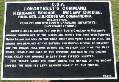
Longstreet's Command.
Kershaw's Brigade, McLaws' Division
Brig. Gen. J.B. Kershaw, commanding.
Organization.
2d, 3d, 7th, and 8th South Carolina Infantry's
(September 17, 1862.)
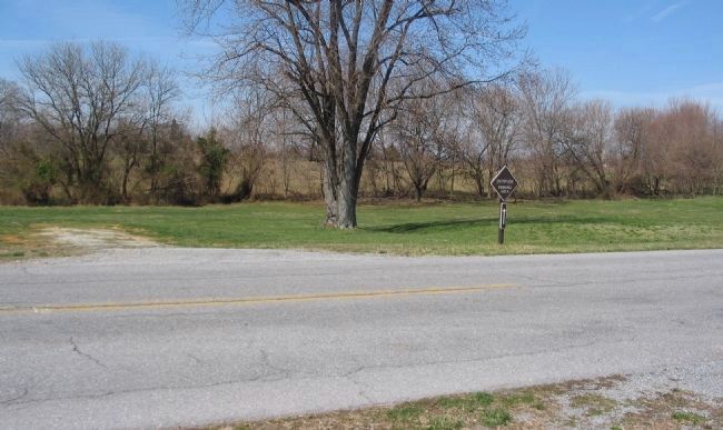
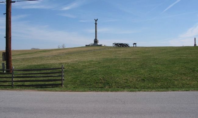
About 9:45 a.m. the 2d, 7th, and 8th South Carolina of Kershaw's Brigade charged out of the woods and across this road upon Tompkins' Rhode Island Battery on the ridge about 220 yards east of this. The charge was repulsed by the battery and Green's Division of infantry, and the brigade fell back beyond the western limits of the West Woods. Nearly one-half of the officers and men of the Brigade were killed and wounded in less than fifteen minutes.
This tablet marks the point where the center of the brigade crossed the road, its left reached nearly to the church.
Erected by Antietam Battlefield Board. (Marker Number 387.)
Topics and series. This historical marker is listed in this topic list: War, US Civil. In addition, it is included in the Antietam Campaign War Department Markers series list. A significant historical date for this entry is September 17, 1862.
Location. 39° 28.491′ N, 77° 44.786′ W. Marker is near Sharpsburg, Maryland, in Washington County. Marker is on Dunker Church Road / Old Hagerstown Pike, on the right when traveling south. Located at the exit to the Antietam Battlefield visitors center, on the opposite side of the road. South of the Dunker Church. Touch for map. Marker is in this post office area: Sharpsburg MD 21782, United States of America. Touch for directions.
Other nearby markers. At least 10 other markers are within walking distance of this marker. 5th, 7th and 66th Ohio Infantry Monument (within shouting distance of this marker); Reserve Artillery, Longstreet's Command (within shouting distance of this marker); Greene's Division, Twelfth Army Corps (within shouting distance of this marker); “I Hate Cannons” (within shouting distance of this marker); “Load” “Commence Firing” (within shouting distance of this marker); Twelfth Army Corps (within shouting distance of this marker); Second Army Corps (within shouting distance of this marker); a different marker also named Twelfth Army Corps (within shouting distance of this marker); a different marker also named Twelfth Army Corps (within shouting distance of this marker); 10-Pounder Parrott Rifle (within shouting distance of this marker). Touch for a list and map of all markers in Sharpsburg.
Related markers. Click here for a list of markers that are related to this marker. Follow Kershaw's Brigade by tablets.
Also see . . .
1. Antietam Battlefield. National Park Service site. (Submitted on April 4, 2008, by Craig Swain of Leesburg, Virginia.)
2. Kershaw's Brigade. In his official report, Kershaw recorded the action here, Our troops made constant progress for some time along the whole line, driving in column after column of the enemy. Colonel Aiken's regiment [7th South Carolina] approached within 30 yards of one of the batteries, driving the men from the guns, and only gave way when enfiladed by a new battery placed in position near them, leaving Major White dead and one-half their men killed or wounded upon the field. (Submitted on April 4, 2008, by Craig Swain of Leesburg, Virginia.)
3. Joseph B. Kershaw. Joseph Brevard Kershaw (January 5, 1822 – April 13, 1894) was a lawyer, judge, and a Confederate general in the American Civil War. (Submitted on October 16, 2015, by Brian Scott of Anderson, South Carolina.)
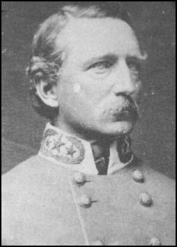
Photographed By Brian Scott
5. Major General Joseph B. Kershaw (1822-1894)
Kershaw was one of six Confederate generals who came from Kershaw County, South Carolina. The others were James Chesnut (1815-1885), James Cantey (1818-1873), Zack Cantey Deas (1819-1882), John Bordenave Villepigue (1830-1862), and John Doby Kennedy (1840-1896).
Photographed By Craig Swain, March 29, 2008
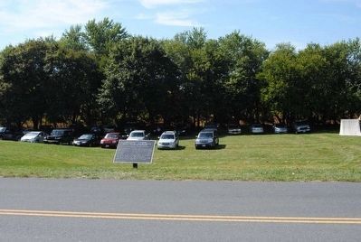
6. Kershaw's Brigade Attacks over the Hagerstown Pike
Looking west over the Dunker Church Road, what was the Hagerstown Pike at the time of the battle, into the overflow parking lot. Kershaw's Brigade attacked with 2nd South Carolina on the left, near the Dunker Church; The 7th South Carolina in the center, crossing about at this point on the road; And the 8th South Carolina dressing on their right.
Photographed By Craig Swain, March 29, 2008
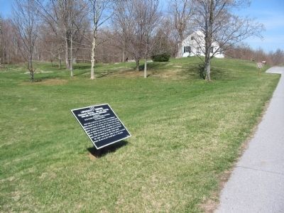
7. What the Men of Kershaw's Brigade Ran Into
Kershaw's Brigade, once crossing the Hagerstown Pike, had to charge up this rise, upon which sat Tompkins' Battery, 1st Rhode Island Battery A, with six 10-pounder Parrott Rifles. On the reverse of the rise were portions of Tindall's and Stainrook's Brigades, from Greene's Division.
Credits. This page was last revised on November 24, 2017. It was originally submitted on April 4, 2008, by Craig Swain of Leesburg, Virginia. This page has been viewed 935 times since then and 16 times this year. Photos: 1. submitted on April 4, 2008, by Craig Swain of Leesburg, Virginia. 2. submitted on October 16, 2015, by Brian Scott of Anderson, South Carolina. 3. submitted on April 4, 2008, by Craig Swain of Leesburg, Virginia. 4, 5. submitted on October 16, 2015, by Brian Scott of Anderson, South Carolina. 6, 7. submitted on April 4, 2008, by Craig Swain of Leesburg, Virginia.
