Ottoville in Putnam County, Ohio — The American Midwest (Great Lakes)
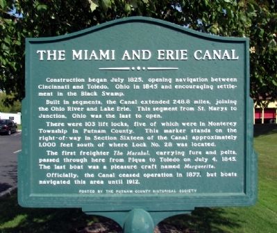
The Miami and Erie Canal
Construction began July 1825, opening navigation between Cincinnati and Toledo, Ohio in 1845 and encouraging settlement in the Black Swamp.
Built in segments, the Canal extended 248.8 miles, joining the Ohio River and Lake Erie. The segment from St. Marys to Junction, Ohio was the last to open.
There were 103 lift locks, five of which were in Monterey Township in Putnam County. This marker stands on the right-of-way in Section Sixteen of the Canal approximately 1,000 feet south of where Lock No. 28 was located.
The first freighter The Marshal, carrying furs and pelts, passed through here from Piqua to Toledo on July 4, 1845. The last boat was a pleasure craft named Marguerita.
Officially, the Canal ceased operation in 1877, but boats navigated this area until 1912.
Erected by Putnam County Historical Society.
Topics and series. This historical marker is listed in this topic list: Waterways & Vessels. In addition, it is included in the The Miami & Erie Canal series list. A significant historical year for this entry is 1825.
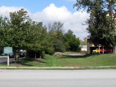
Location. 40° 56.074′ N, 84° 20.324′ W. Marker is in Ottoville, Ohio, in Putnam County. Marker is on E. Main Street east of W. Canal Street, on the left when traveling east. Touch for map. Marker is at or near this postal address: 120 E Main Street, Ottoville OH 45876, United States of America. Touch for directions.
Other nearby markers. At least 8 other markers are within walking distance of this marker. Robert "Bob" L. Brinkman (about 600 feet away, measured in a direct line); 09.11.2001 (approx. 0.2 miles away); V.F.W. Post 3740 Veterans Memorial (approx. 0.2 miles away); Honor Roll (approx. 0.2 miles away); The Miami And Erie Canal (approx. ¼ mile away); The Canal's Locks And Narrowboats (approx. ¼ mile away); Ottoville (approx. 0.3 miles away); Immaculate Conception Cemetery Veterans Memorial (approx. half a mile away). Touch for a list and map of all markers in Ottoville.
Also see . . . The Miami and Erie Canal. Wikipedia entry (Submitted on December 31, 2023, by Larry Gertner of New York, New York.)
Credits. This page was last revised on February 10, 2024. It was originally submitted on October 4, 2013, by Duane Hall of Abilene, Texas. This page has been viewed 779 times since then and 27 times this year. Photos: 1, 2. submitted on October 4, 2013, by Duane Hall of Abilene, Texas.

