Near Chili in Coshocton County, Ohio — The American Midwest (Great Lakes)
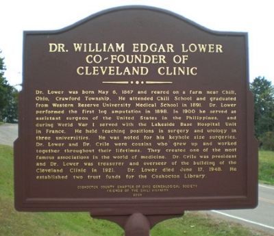
Dr. William Edgar Lower Co-Founder of Cleveland Clinic
Inscription.
Dr. Lower was born May 6, 1867 and reared on a farm near Chili, Ohio, Crawford Twp. He attended Chili School and graduated from Western Reserve University Medical School in 1891. Dr. Lower performed the first leg amputation in 1898. In 1900 he served as assistant surgeon of the United States in the Philipines, and during World War I served with the Lakeside Base Hospital Unit in France. He held teaching positions in surgery and urology in three universities. He was noted for his keyhole size surgeries. Dr. Lower and Dr. Crile were cousins who grew up and worked together throught their lifetimes. They created one of the most famous associations in the world of medicine. Dr. Crile was president and Dr. Lower was treasurer and overseer of the building of the Cleveland Clinic in 1921. Dr. Lower died June 17, 1948. He established two trust funds for the Coshocton Library.
Erected 2004 by Coshocton County Chapter of Ohio Genealogical Society. Friends of Chili Vicinity.
Topics. This historical marker is listed in this topic list: Science & Medicine. A significant historical month for this entry is May 1803.
Location. 40° 21.433′ N, 81° 45.822′ W. Marker is near Chili, Ohio, in Coshocton County. Marker is at the intersection of Township Road. (Local Route 171) and County Route 10 on Township Road.. Touch for map. Marker is in this post office area: Coshocton OH 43812, United States of America. Touch for directions.
Other nearby markers. At least 8 other markers are within 8 miles of this marker, measured as the crow flies. North Appalachian Experimental Watershed (approx. 1.8 miles away); Koquechagachton (approx. 4½ miles away); Pennsylvania National Guard Troop Train Accident, September 1950 (approx. 5.6 miles away); West Lafayette Volunteer Fire Department Centennial (approx. 5.7 miles away); West Lafayette War Memorial (approx. 6.4 miles away); Old Stone Fort (approx. 6.9 miles away); Broadhead Massacre (approx. 7.1 miles away); Bouquet’s Camp (approx. 7.1 miles away).
Also see . . . "Find a Grave" ::. (Submitted on October 9, 2013.)
Credits. This page was last revised on November 5, 2016. It was originally submitted on October 8, 2013, by Peter Arthur Lower Rodgers of Elkhart, Indiana. This page has been viewed 940 times since then and 24 times this year. Photo 1. submitted on October 8, 2013, by Peter Arthur Lower Rodgers of Elkhart, Indiana. • Al Wolf was the editor who published this page.
Editor’s want-list for this marker. Wide view photo showing entire marker. Any other information would be appreciated. Please add to this marker. • Can you help?
