Michigan Bluff in Placer County, California — The American West (Pacific Coastal)
Michigan Bluff to Last Chance
Inscription.
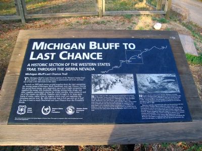
A historic section of the Western States Trail through the Sierra Nevada.
Michigan Bluff–Last Chance Trail. The Michigan Bluff to Last Change section of the Western States Trail was built in 1850 and later became a maintained toll-trail, perhaps one of only a few toll-trails in the state.
As early as 1850 pack-trains carried supplies down the trail connecting the mining camps of Michigan Bluff, Deadwood, and Last Change. During this period these camps were dependent upon local friend companies who supplied the camps with foodstuffs, clothing, mining tools, drugs, and other supplies, particularly during the winder months, when access in and out of the camps was difficult. Supplies were brought in by large pack-trains of mules, rather than by wagons which could not negotiate the circuitous narrow trail. By 1952 this trail was in full use and cut in half the time it took to reach Deadwood and Last Chance from the Foresthill Divide.
(photo caption) Between 1849 and 1850, mining camps located along the present-day Foresthill Divide were difficult to reach by foot, or by wagon. By 1851, the business communities of Michigan City (later Michigan Bluff), Deadwood, and Last Chance, were doing well, and the population was increasing, as was gold production. Many of the camps such as Deadwood and Last Chance could only be reached by foot, pack trains, or by horseback along a precipitous trail. Millions of dollars in value and several tons in weight of gold was packed out by mule trains over many years along the Michigan Bluff to Last Chance trail.
(photo caption) High upon the brow of two river canyons, clinging to its steep slopes in Michigan Bluff. Once an active city of commerce of 3,000 people, its mines shipped out $100,000 in gold each month from 1851 to 1884. Leland Stanford, railroad builder, U.S. Senator, Governor, and donor to Stanford University, laid the foundation for his fortune here from 1853 to 1855.
Blasting, washing, and sluicing for gold was devastating as the face of the country changed. What would have taken centuries to accomplish by natural processes was produced in a few years. Soil to the depth of 150 feet was washed from acres of land, exposing only bedrock. Slopes stripped of trees and chaparral were subject to severe erosion and landslides. The miners washing an ancient river channel found the city perched on the canyon edge beginning to move. Michigan City began to settle and slip threatening to precipitate the town into the abyss. In 1859 the city was moved to its present site.
Erected by USDA Forest Service, Western Trails Foundation, Western States Endurance Run.
Topics. This historical marker is listed in these topic lists: Roads & Vehicles • Settlements & Settlers. A significant historical year for this entry is 1850.
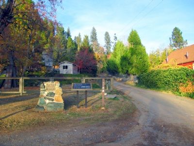
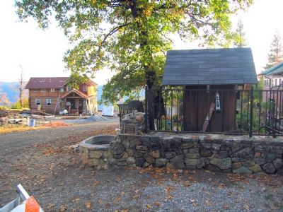
Location. 39° 2.463′ N, 120° 44.086′ W. Marker is in Michigan Bluff, California, in Placer County. Marker is at the intersection of Michigan Bluff Road and Turkey Hill Road, on the left when traveling east on Michigan Bluff Road. Touch for map. Marker is in this post office area: Foresthill CA 95631, United States of America. Touch for directions.
Other nearby markers. At least 5 other markers are within 5 miles of this marker, measured as the crow flies. Michigan Bluff (about 600 feet away, measured in a direct line); Pioneers of Deadwood
(approx. 3.7 miles away); St. Joseph’s Catholic Church Bell (approx. 4.3 miles away); Foresthill School Bell (approx. 4.4 miles away); Foresthill Protestant Cemetery (approx. 4.4 miles away).
Also see . . .
1. The Western States Endurance Run. Event website homepage:
"The Run is conducted along the Western States Trail starting at Squaw Valley, California, and ending in Auburn, California, a total of 100 miles." (Submitted on November 15, 2006, by Karen Key of Sacramento, California.)
2. The Tevis Cup. The Western States Trail Ride website homepage:
"The Western States Trail Ride is the oldest of several events that have helped Auburn, California, earn the title of 'Endurance Capital of the World.'" (Submitted on November 15, 2006, by Karen Key of Sacramento, California.)
Additional commentary.
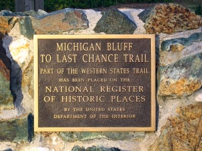
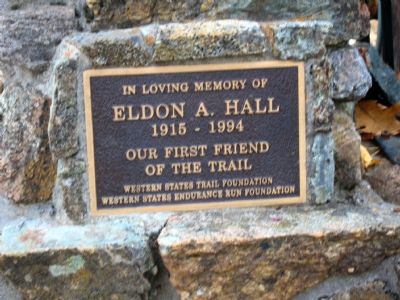
1. Eldon A. Hall Memorial Marker
Eldon A. Hall was my Grandfather. Thank you for honoring him. He was a wonderful man.
Blessings Miriam R. Poncer
— Submitted June 24, 2009, by Miriam R. Poncer of Dayton, Ohio.
Credits. This page was last revised on December 27, 2021. It was originally submitted on November 15, 2006, by Karen Key of Sacramento, California. This page has been viewed 4,846 times since then and 44 times this year. Photos: 1, 2, 3, 4, 5. submitted on November 15, 2006, by Karen Key of Sacramento, California. • J. J. Prats was the editor who published this page.
