Annandale in Fairfax County, Virginia — The American South (Mid-Atlantic)
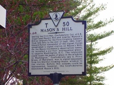
Masonís Hill
Erected 2000 by Department of Historic Resources. (Marker Number T-50.)
Topics and series. This historical marker is listed in this topic list: War, US Civil. In addition, it is included in the Virginia Department of Historic Resources (DHR) series list. A significant historical month for this entry is September 1861.
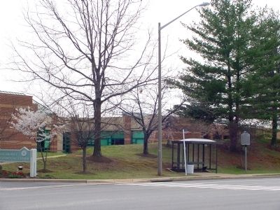
Location. 38° 50.267′ N, 77° 9.8′ W. Marker is in Annandale, Virginia, in Fairfax County. Marker is at the intersection of Columbia Pike (Virginia Route 244) and Maplewood Drive, on the right when traveling north on Columbia Pike. It is at the bus stop at the Mason District Governmental Center. Touch for map. Marker is at or near this postal address: 6507 Columbia Pike, Annandale VA 22003, United States of America. Touch for directions.
Other nearby markers. At least 8 other markers are within 2 miles of this marker, measured as the crow flies. Mount Pleasant Baptist Church (approx. 0.3 miles away); a different marker also named Mason's Hill (approx. 0.6 miles away); Historic Green Spring (approx. 0.9 miles away); Action At Annandale (approx. 1.4 miles away); The Cannon (approx. 1.7 miles away); J.E.B. Stuart at Munsonís Hill (approx. 1.8 miles away); Little River Turnpike (approx. 1.9 miles away); Baileyís Crossroads Civil War Engagements (approx. 1.9 miles away). Touch for a list and map of all markers in Annandale.
Also see . . . General Edward Porter Alexander. Multi-page article by Colonel Jack Travis on The Cape Fear War Roundtable website. “Being on the staff of General Beauregard, Alexander was given an unusual assignment to do some secret service work. The Confederates needed more information on the movements and troop strength of the Federal army. Alexander created a system of spies and methods of receiving their information. He appointed E. Pliny Bryan, of Maryland, as his chief spy. With Bryan in Washington, DC, Alexander could receive signal messages. Bryan would get a room in a hotel that Alexander could see from Mason Hill in adjacent Virginia with his telescope, and would signal Alexander with a coffee pot reflecting from the sun or movement of the window drapes. This method worked extremely well. The famous Rose OíNeal Greenhowe, Augusta Morris, and Mrs. Baxley were in this system of spies. Unfortunately, this all ended. The Federals got suspicious and arrested them all. However, they were later released due to insufficient evidence.” (Submitted on April 5, 2008.)
Credits. This page was last revised on June 16, 2016. It was originally submitted on April 5, 2008, by J. J. Prats of Powell, Ohio. This page has been viewed 2,514 times since then and 78 times this year. Photos: 1, 2. submitted on April 5, 2008, by J. J. Prats of Powell, Ohio. • Craig Swain was the editor who published this page.

