Wilson-Conococheague in Washington County, Maryland — The American Northeast (Mid-Atlantic)
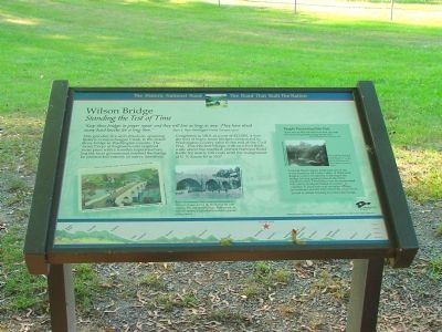
Wilson Bridge
Standing the Test of Time
— The Historic National Road - The Road That Built The Nation —
“Keep these bridges in proper repair and they will last as long as any. They have stood many hard knocks for a long time.” —Elmer E. Piper, Washington County Surveyor, 1920s.
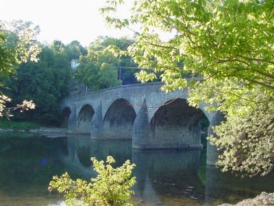
This graceful, five-arch structure, spanning historic Conococheague Creek, is the oldest stone bridge in Washington County. The Army Corps of Engineers only required stone piers with a wooden superstructure, but the local government insisted the bridge be constructed entirely of native limestone.
Completed in 1919, at a cost of $12,000, it was the first of thirty stone bridges constructed in Washington County prior to the end of the Civil War. This 210-foot bridge, with two-foot thick walls above the roadbed, carried National Road traffic for nearly 120 years until the realignment of U.S. Route 40 in 1937.
[Sidebar:]
People Preserving their Past.
“If you went out there and stood in the dark, you could hear small rocks gradually sloping into the creek.” —Glenn Dull , Washington County Engineer, 1982.
Tropical Storm Agnes produced one of the worst floods in the Great Valley of Maryland. Raging waters completely submerged the bridge leaving gaping holes in the stone superstructure. Demolition was recommended but county residents raised an outcry. A coalition of local historical societies, county government and the Maryland Historical Trust united to obtain funding to restore the bridge.
[Captions:]
The crumbling remains of the middle arches in 1982. LeRoy Myers, Sr., a Clear Spring contractor and stone mason, restored the bridge.
Row’s Amusement Park attracted thousands to Wilson’s Bridge during the first half of the 20th century. The park featured rides, bath houses, an open-air theatre, a dance/ball room and a popular sliding board.
Topics and series. This historical marker is listed in these topic lists: Bridges & Viaducts • Roads & Vehicles. In addition, it is included in the The Historic National Road series list. A significant historical year for this entry is 1919.
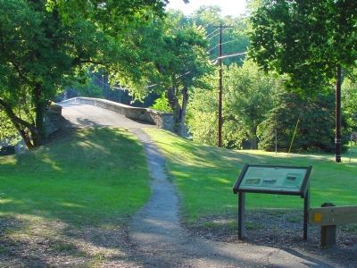
Location. 39° 39.466′ N, 77° 50.828′ W. Marker is in Wilson-Conococheague, Maryland, in Washington County. Marker is on Wilson Bridge Park Lane west of Baltimore National Pike (U.S. 40), on the left when traveling west. Marker is in Wilson Bridge Park, in front of the bridge. Touch for map. Marker is in this post office area: Hagerstown MD 21740, United States of America. Touch for directions.
Other nearby markers. At least 5 other markers are within one mile of this marker, measured as the crow flies. A different marker also named Wilson Bridge (about 300 feet away, measured in a direct line); Gettysburg Campaign (approx. ¼ mile away); Wilson’s Store (approx. ¼ mile away); “The Bank Road” (approx. 0.6 miles away); a different marker also named Gettysburg Campaign (approx. 1.1 miles away).
Also see . . .
1. Wilson Bridge. Bridgemeister website entry (Submitted on November 18, 2006.)
2. Wilson Bridge. Nation Register of Historic Places Nomination Form (Submitted on February 23, 2022, by Larry Gertner of New York, New York.)
Credits. This page was last revised on October 25, 2023. It was originally submitted on November 18, 2006, by J. J. Prats of Powell, Ohio. This page has been viewed 2,441 times since then and 18 times this year. Photos: 1, 2, 3. submitted on November 18, 2006, by J. J. Prats of Powell, Ohio.


