Kinston in Lenoir County, North Carolina — The American South (South Atlantic)
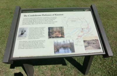
The Confederate Defenses of Kinston
Harriet's Chapel Battlefield Park
— Battle of Kinston Military Park —
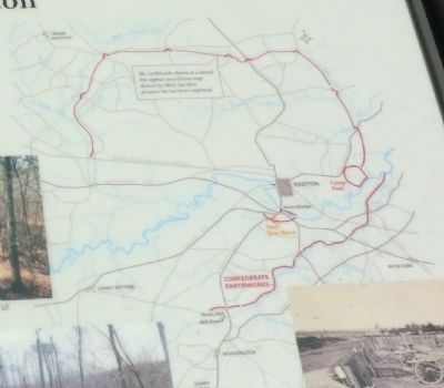
Confederate engineers used Southwest Creek as a natural barrier, fortifying three bridges across the creek. They constructed earthworks on both sides of roads just north of the bridges, anchoring the works on swamps. The engineers believed that the Union troops could not or would not try to cross the swamps. They would have to assault the works head on.
North of Kinston, a ring of earthworks stretched from the river to the railroad on the city’s west edge. Camp Pool, a large fortified encampment east of the city, mounted heavy artillery protecting the Neuse River approach to Kinston. Obstructions placed in the river forced boats to pass through a narrow channel, making them easy targets.
(captions)
(left) Gen. Nathan G. “Shanks” Evans, commander of the Confederate forces at Kinston.
(upper center) Earthworks at Southwest Creek near Hines Mill.
(lower center) Swamps provided a formidable natural barrier.
(lower right) The earthworks around Kinston probably resembled this earthwork near Atlanta.
Erected by Battle of Kinston Military Park.
Topics. This historical marker is listed in this topic list: War, US Civil.
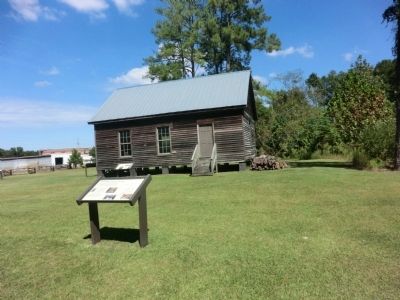
Location. 35° 14.502′ N, 77° 35.281′ W. Marker is in Kinston, North Carolina, in Lenoir County. Marker is at the intersection of Richlands Road (U.S. 258) and Measley Road, on the right when traveling north on Richlands Road. The marker is located on the grounds of the Kinston Battlefield Park. Touch for map. Marker is in this post office area: Kinston NC 28504, United States of America. Touch for directions.
Other nearby markers. At least 8 other markers are within walking distance of this marker. Caring for the Wounded (a few steps from this marker); The Site of Harriet's Chapel (a few steps from this marker); The Night of December 13, 1862 (within shouting distance of this marker); Fighting at Harriet's Chapel (within shouting distance of this marker); Kinston Battlefield Park (within shouting distance of this marker); Wessells' Advance—December 14, 1862 (within shouting distance of this marker); The Center of the Confederate Line (within shouting distance of this marker); The Action in the Swamp (within shouting distance of this marker). Touch for a list and map of all markers in Kinston.
Credits. This page was last revised on June 16, 2016. It was originally submitted on November 26, 2013, by Don Morfe of Baltimore, Maryland. This page has been viewed 809 times since then and 19 times this year. Photos: 1, 2, 3. submitted on November 26, 2013, by Don Morfe of Baltimore, Maryland. • Bernard Fisher was the editor who published this page.


