Batesville in Independence County, Arkansas — The American South (West South Central)
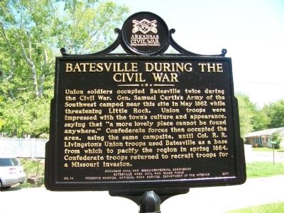
Batesville During The Civil War
Erected 2011 by Arkansas Civil War Sesquicentennial Commission, Batesville Area Civil War Round Table. (Marker Number 14.)
Topics and series. This historical marker is listed in this topic list: War, US Civil. In addition, it is included in the Arkansas Civil War Sesquicentennial Commission series list. A significant historical month for this entry is May 1862.
Location. 35° 46.343′ N, 91° 38.649′ W. Marker is in Batesville, Arkansas, in Independence County. Marker is on South 9th Street north of Vine Street, on the left when traveling north. Touch for map. Marker is at or near this postal address: 380 South 9th Street, Batesville AR 72501, United States of America. Touch for directions.
Other nearby markers. At least 8 other markers are within walking distance of this marker. Bethel African Methodist Episcopal Church (about 400 feet away, measured in a direct line); Original Building, Arkansas College (about 800 feet away); Charles R. Handford House (approx. 0.2 miles away); Arkansas College (approx. 0.2 miles away); Peed-Ball House (approx. ¼ mile away); Arkansas Methodist Conference (approx. 0.3 miles away); Lafferty Memorial Church (approx. 0.3 miles away); Independence County Office and Library (approx. 0.4 miles away). Touch for a list and map of all markers in Batesville.
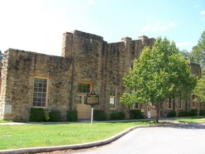
More about this marker. Located in front of the Old Independence Regional Museum in the foothills of the Ozarks in Batesville, Arkansas, the museum preserves and presents the history of 12 counties that were part of Independence County in 1820: Baxter, Cleburne, Fulton, Independence, Izard, Jackson, Marion, Poinsett, Sharp, Stone, White, and Woodruff.
Also see . . . Old Independence Regional Museum ::. (Submitted on December 5, 2013.)
Credits. This page was last revised on January 20, 2020. It was originally submitted on December 3, 2013, by Judy King of Pittsburgh, Pennsylvania. This page has been viewed 1,547 times since then and 73 times this year. Photos: 1, 2. submitted on December 3, 2013, by Judy King of Pittsburgh, Pennsylvania. • Al Wolf was the editor who published this page.

