Union Township near Winfield in Union County, Pennsylvania — The American Northeast (Mid-Atlantic)
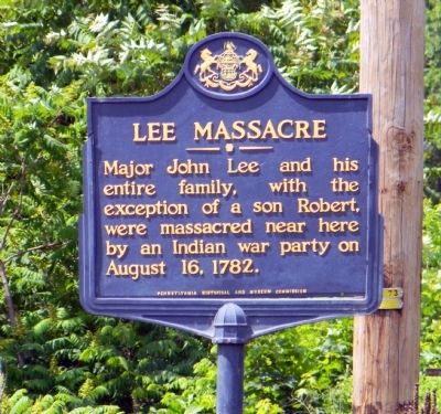
Lee Massacre
Erected 1947 by Pennsylvania Historical and Museum Commission.
Topics and series. This historical marker is listed in these topic lists: Colonial Era • Settlements & Settlers • War, US Revolutionary. In addition, it is included in the Pennsylvania Historical and Museum Commission series list. A significant historical year for this entry is 1782.
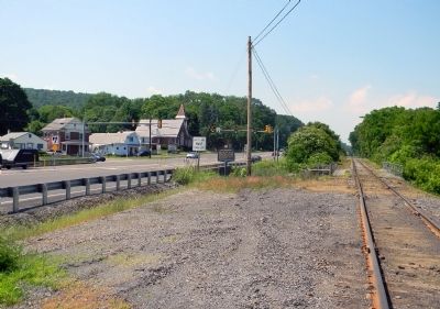
Location. 40° 54.658′ N, 76° 51.212′ W. Marker is near Winfield, Pennsylvania, in Union County. It is in Union Township. Marker is at the intersection of Westbranch Highway (U.S. 15) and Pennsylvania Route 304, on the right when traveling north on Westbranch Highway. With recent reconstruction of US-15 and the intersecting roads, the safest way to access the Lee Massacre Marker to exit US-15N at Reitz Ave, then drive north until the street dead ends at the railroad tracks. Carefully crossing the tracks, the marker is visible between US-15 and the tracks. Touch for map. Marker is at or near this postal address: 43 Reitz Ave, Winfield PA 17889, United States of America. Touch for directions.
Other nearby markers. At least 8 other markers are within 4 miles of this marker, measured as the crow flies. West Branch Susquehanna River Water Trail (approx. 2.2 miles away); Joseph Priestley (approx. 2˝ miles away); 1st. Lt. Carl F. Cooke (approx. 2.8 miles away); Veterans Memorial (approx. 2.8 miles away); Civil War Memorial (approx. 2.8 miles away); Town Clock and Chimes (approx. 3.3 miles away); War Memorial (approx. 3.3 miles away); a different marker also named Veterans Memorial (approx. 3.3 miles away).
Credits. This page was last revised on February 7, 2023. It was originally submitted on June 17, 2011, by PaulwC3 of Northern, Virginia. This page has been viewed 4,075 times since then and 307 times this year. Last updated on December 9, 2013, by Mollie Kirby of St Paul, Minnesota. Photos: 1, 2. submitted on June 17, 2011, by PaulwC3 of Northern, Virginia. 3. submitted on December 9, 2013. • Bill Pfingsten was the editor who published this page.


