Derry-Londonderry in Derry And Strabane, Northern Ireland, United Kingdom — Northwestern Europe (the British Isles)
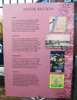
Water Bastion
Feabhail
The river Foyle lapped against the Water Bastion until the late 18th century. The name Foyle probably arose because English-speaking settlers had difficulty saying the Irish 'Feabhail', used traditionally to describe the stretch of water from the sea to Strabane. Some say that it took its name from the legendary chieftain Feabhail who was drowned by a giant wave. The truth is simpler. The word comes from the Welsh for a 'lip', describing the shape of the estuary.
Lundy's escape
Disgraced Governor Robert Lundy escaped over the wall near here during the 1689 siege. Suspected of plotting to surrender the city to James II, he was removed from office on 19th April. The next night the new Governors Henry Baker and George Walker helped Lundy, disguised as an ordinary soldier, to escape the fury of the crowd. He climbed through the branches of a pear tree growing against the wall before being ferried from Shipquay Gate to board a ship for Scotland. The name Orchard Street recalls the scene of his flight.
Smugglers Ahoy!
The quay of Derry is broad and convenient and vessels of 600 ton may float on it...The trade increases very much - but smuggling continues to thrive. In the late 1780s six companies of soldiers were brought in to pursue smugglers who, if caught, could face the death penalty. Less than half a century later convicted smugglers joined a new type of vessel at the quays - the convict ships bound for the penal colonies of Australia.
'Casbah Rock'
Five young men put the city on the punk map. The Undertones started out playing gigs at the Casbah bar on Foyle Street in 1976. Their debut single - 'Teenage Kicks' - so inspired legendary DJ John Peel that he declared it to be his favourite record of all time. Four albums and thirteen singles later, the band split in 1983. The Undertones have since come together again with a new vocalist. Their first appearance celebrated the opening of the Nerve Centre, the city's multimedia arts base in 2001.
Topics. This historical marker is listed in these topic lists: Entertainment • Forts and Castles • Man-Made Features • Settlements & Settlers. A significant historical year for this entry is 1689.
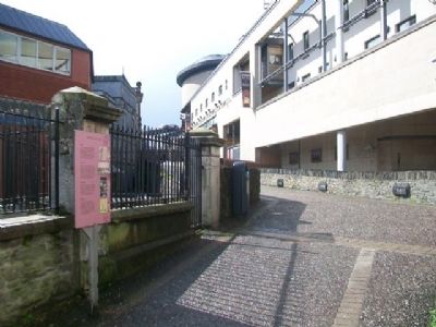
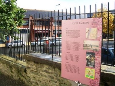
Location. 54° 59.775′ N, 7° 19.118′ W. Marker is in Derry-Londonderry, Northern Ireland, in Derry And Strabane. Marker is on the City Wall walking path, just west of Foyle Street. Touch for map. Marker is in this post office area: Derry-Londonderry, Northern Ireland BT48 6AL, United Kingdom. Touch for directions.
Other nearby markers. At least 8 other markers are within walking distance of this marker. Shipquay Gate (about 90 meters away, measured in a direct line); Arthur Joyce Lunel Cary (about 90 meters away); Newmarket Street
(about 120 meters away); Shipquay Street (about 120 meters away); a different marker also named Shipquay Gate (about 120 meters away); The Walled City (about 120 meters away); … Free, entire and perfect (about 120 meters away); Guildhall Square (about 120 meters away). Touch for a list and map of all markers in Derry-Londonderry.
Also see . . .
1. The Siege of Derry (1689). (Submitted on January 4, 2014, by William Fischer, Jr. of Scranton, Pennsylvania.)
2. The Undertones. (Submitted on January 4, 2014, by William Fischer, Jr. of Scranton, Pennsylvania.)
Credits. This page was last revised on August 27, 2020. It was originally submitted on January 4, 2014, by William Fischer, Jr. of Scranton, Pennsylvania. This page has been viewed 369 times since then and 20 times this year. Photos: 1, 2, 3. submitted on January 4, 2014, by William Fischer, Jr. of Scranton, Pennsylvania.


