Cumberland in Allegany County, Maryland — The American Northeast (Mid-Atlantic)
McNeill’s Raid
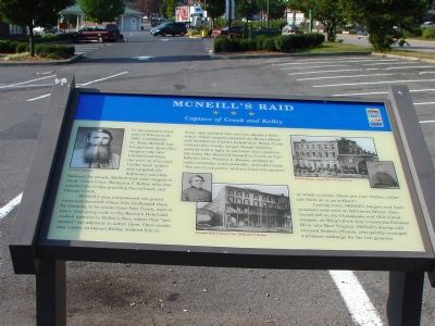
Capture of Crook and Kelly
In the predawn darkness of February 21, 1865, Confederate Lt. Jesse McNeill and his partisan (guerrilla) rangers rode into Cumberland from the west on this road. Unlike most raiders who targeted the Baltimore and Ohio Railroad for attack, McNeill had other targets in mind: Union Gens. Benjamin F. Kelley, who commanded the troops guarding the railroad, and George Crook.
McNeill's men overpowered two guard units and deceived others who challenged them by claiming to be scouts from New Creek, west of town. One group rode to the Barnum Hotel and rushed upstairs to Kelley's door, where they "persuaded" his adjutant to admit them. Once inside, they rudely awakened Kelley, ordered him to dress, and marched him and the adjutant downstairs. Other rangers occupied the Revere House and knocked on Crook's locked door. When Crook invited them inside, ranger Joseph Vandiver entered with a light in one hand and a pistol in the other. He identified himself to Crook as Confederate Gen. Thomas L. Rosser, perhaps to make surrender more palatable, and told Crook, "You are in my power, and you have two minutes in which to dress. There are your clothes; either put them on or go without."
Leaving town, McNeill's rangers and their prisoners rode west on Baltimore Street, then turned left on the Chesapeake and Ohio Canal towpath. At Wiley's Ford, they crossed the Potomac River into West Virginia. McNeill's daring raid stunned Federal officials, who quickly arranged a prisoner exchange for the two generals.
Topics and series. This historical marker is listed in this topic list: War, US Civil. In addition, it is included in the Chesapeake and Ohio (C&O) Canal, and the Maryland Civil War Trails series lists. A significant historical date for this entry is February 21, 1987.
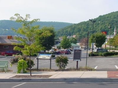
Location. 39° 39.133′ N, 78° 45.546′ W. Marker is in Cumberland, Maryland, in Allegany County. Marker is at the intersection of Baltimore Street and Queen City Drive, on the left when traveling east on Baltimore Street. Touch for map. Marker is at or near this postal address: 166 Baltimore St, Cumberland MD 21502, United States of America. Touch for directions.
Other nearby markers. At least 8 other markers are within walking distance of this marker. Capture of Generals (here, next to this marker); A Boom for Cumberland (within shouting distance of this marker); Capture of Generals B.F. Kelly and George Crook (within shouting distance of this marker); Christ's (St. Paul's) Lutheran Church (about 600 feet away, measured in a direct line); B’er Chayim (Well of Life) Congregation (about 700 feet away); Welcome (about 700 feet away); The First National Bank and Trust Company of Western Maryland (about 700 feet away); Girritta Park (approx. 0.2 miles away). Touch for a list and map of all markers in Cumberland.

circa 1868
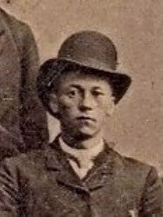
3. Sprigg Singleton Lynn 1844 - 1898
Sprigg Lynn served with Jesse McNeill's Virginia Cavalry Battalion as an irregular in the Cumberland, Maryland area and participated in the kidnapping of Generals Crook and Kelly from their hotel rooms in Cumberland. Private Sprigg Lynn was captured and escaped five times until his unit was disbanded.
Credits. This page was last revised on June 11, 2022. It was originally submitted on November 25, 2006, by J. J. Prats of Powell, Ohio. This page has been viewed 4,571 times since then and 330 times this year. Last updated on August 28, 2020, by Bradley Owen of Morgantown, West Virginia. Photos: 1. submitted on November 25, 2006, by J. J. Prats of Powell, Ohio. 2. submitted on August 18, 2006, by J. J. Prats of Powell, Ohio. 3. submitted on January 31, 2010, by 'Capt' South T. Lynn of Darnestown, Maryland. • Bill Pfingsten was the editor who published this page.

