Hunt in Jerome County, Idaho — The American West (Mountains)
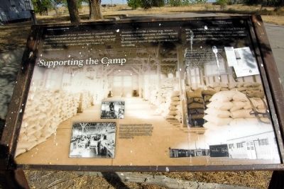
Supporting the Camp
Toshio Toyoji and his 44 whse. (warehouse) 20 carpenters make and finish practically all of the office furniture. They remodel and alter barracks for schools and evacuee housing as well as the staff housing. The project sign shop is also located in whse. 20.
The Minidoka Interlude, 1943
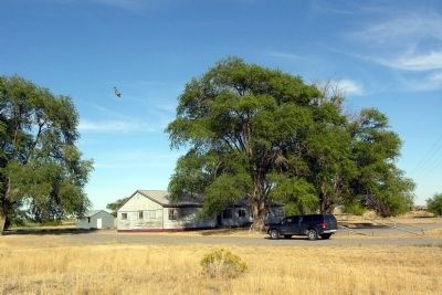
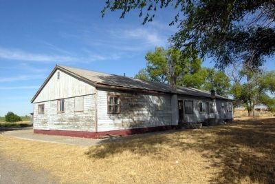
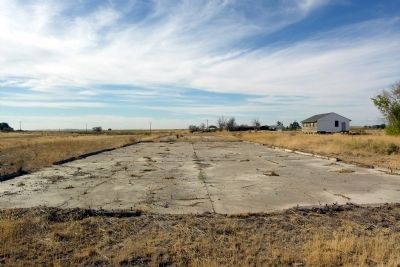
Minidoka was run like a military post. You are standing in its warehouse area. A lumber yard and 17 warehouse buildings were located here. The buildings were used for storage, maintenance, and sign making.
With over 9,000 internees, plus the civilian WRA staff who oversaw the camp’s operation, large quantities of food, parts, building materials, tools, work clothes, and cleaning supplies were kept here.
(Upper Right Photo Caption)
On November 11, 1942, a special moment arrived in the warehouse area. (Illegible),000 Japanese books, many art prints, and various personal items–all confiscated from internees when imprisoned at the Camp Harmony and Portland assembly centers–were returned to residents.
(Lower Center Photos Caption)
Internees turned one warehouse into a shop classroom, where they learned job skills like auto repair, farm equipment repair, welding, and carpentry.
Erected by National Park Service.
Topics. This historical marker is listed in these topic lists: Asian Americans • Civil Rights • War, World II. A significant historical month for this entry is November 1886.
Location. 42° 40.709′ N, 114° 14.633′ W. Marker is in Hunt, Idaho, in Jerome County. Marker can be reached from Hunt Road, 0.2 miles east of County Road S1400E, on the left when traveling east. Marker is located in Minidoka National Historic Site. Touch for map. Marker is in this post office area: Jerome ID 83338, United States of America. Touch for directions.
Other nearby markers. At least 8 other markers are within walking distance of this marker. Swimming Hole (about 500 feet away, measured in a direct line); Censored Mail (approx. 0.3 miles away); Running a Camp (approx. 0.3 miles away); Honor Roll (approx. 0.4 miles away); A Question of Loyalty (approx. 0.4 miles away); Minidoka National Historic Site (approx. 0.4 miles away); On Guard (approx. 0.4 miles away); Soothing Waters (approx. 0.4 miles away). Touch for a list and map of all markers in Hunt.
Also see . . . Minidoka National Historic Site. Official National Park Service website. (Submitted on February 15, 2014.)
Credits. This page was last revised on June 16, 2016. It was originally submitted on February 15, 2014, by Duane Hall of Abilene, Texas. This page has been viewed 606 times since then and 15 times this year. Photos: 1, 2, 3, 4. submitted on February 15, 2014, by Duane Hall of Abilene, Texas.
Editor’s want-list for this marker. Photo of wide-view of marker and surroundings. • Can you help?


