Fredericksburg, Virginia — The American South (Mid-Atlantic)
Fredericksburg's Wharves and Harbor
Inscription.
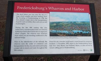
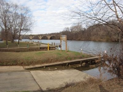
The dock before you was once the site of a large wharf complex and ferry landing. From the founding of Fredericksburg in 1728, the river played a major role in the transportation of goods such as timber, flour and corn as well as passengers.
During the late 18th century, this area underwent a transformation from an informal scattering of individual docks into an organized wharf complex. The wharves once stretched from where you are standing northward to the railroad bridge.
Prior to the introduction of the railroad, the wharves were the center of commerce and transportation for the city and continued to play a major role in travel and trade throughout the 19th century.
From this site a traveler could board a vessel bound for numerous locations. A November, 1855, report in the Fredericksburg News lists New York, Boston and Portland, Maine, as cities served by vessels calling port in Fredericksburg.
Erected by University of Mary Washington.
Topics. This historical marker is listed in these topic lists: Industry & Commerce • Waterways & Vessels. A significant historical month for this entry is November 1855.
Location. 38° 17.781′ N, 77° 27.185′ W. Marker is in Fredericksburg, Virginia. Marker is at the intersection of Sophia Street and Frederick Street, on the left when traveling south on Sophia Street. Located in City Dock Park. Touch for map. Marker is in this post office area: Fredericksburg VA 22401, United States of America. Touch for directions.
Other nearby markers. At least 8 other markers are within walking distance of this marker. George Washington’s Boyhood Home at Ferry Farm (here, next to this marker); Fredericksburg City Dock (within shouting distance of this marker); Washington's Boyhood Home (within shouting distance of this marker); a different marker also named Fredericksburg City Dock (within shouting distance of this marker); a different marker also named Fredericksburg City Dock (within shouting distance of this marker); Rocky Lane (within shouting distance of this marker); No Outlet (about 300 feet away, measured in a direct line); The Slave Ship Othello (about 300 feet away). Touch for a list and map of all markers in Fredericksburg.
Credits. This page was last revised on February 2, 2023. It was originally submitted on March 9, 2014, by Craig Swain of Leesburg, Virginia. This page has been viewed 1,120 times since then and 70 times this year. Photos: 1, 2, 3. submitted on March 9, 2014, by Craig Swain of Leesburg, Virginia.


