Parkers Crossroads in Henderson County, Tennessee — The American South (East South Central)
"Give 'Em Hell"
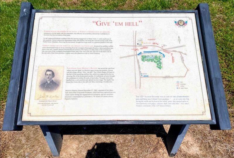
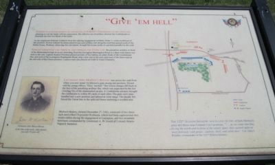
Forrest placed the burden of the battle at Parker's Crossroads on his artillery, planning to win the battle with his cannoneers. His effective use of artillery allowed the Confederates to dominate the first two-thirds of the battle.
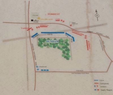
As the outgunned Federals withdrew from the opening engagement at Hicks' field, 1¼ miles northwest of this position, Forrest ordered his dismounted troops and artillery east along the road that passed south of the Parker house. Dunham, observing this movement, brought his troops north, to a position parallel to the road.
Forrest formed his line north of and opposite the Union line. He placed his artillery in front of his dismounted troops in an arc stretching from the Lexington-Huntingdon Road to a farm road almost one mile to the east. Captain Samuel Freeman placed sections of his battery on either flank of the Confederate line, just west of the Lexington-Huntingdon Road, atop a low rise to the east, and west of the farm road on the east side of the Union position. Cannon were also placed on a hill in Jones Cemetery.
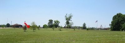
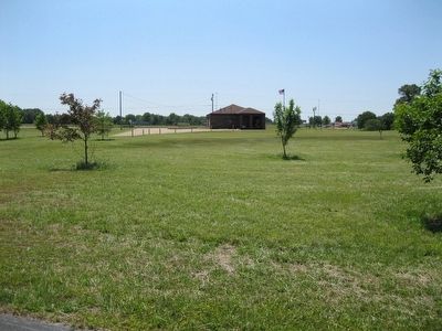
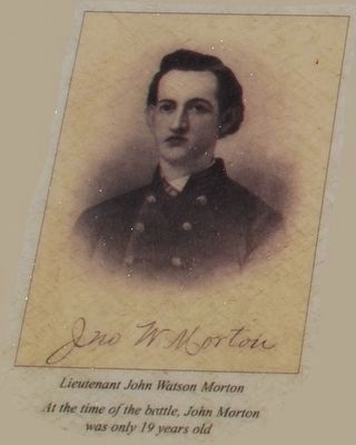
Lieutenant John Morton's Battery was across the road from where you now stand. As Morton's guns swung into position, Forrest told the young officer, "Give 'em hell." Two Union charges fell back in the face of the punishing artillery fire, which was supported by the low covering fire of the dismounted cavalry. A Confederate advance brought the combatants to within 80 yards of each other. The guns were manhandled into a new position and opened at close range. The deadly fire forced the Union line to the split-rail fence enclosing a wooded area.
Morton's Battery, formed December 27, 1862, consisted of two three-inch steel-rifled 10-pounder Rodmans, which had been captured just two weeks earlier during the engagement at Lexington, and two mountain howitzers commanded by Lieutenant A.W. Gould of Colonel Alonzo Napier's battalion.
Erected by Parker's Crossroads Battlefield Association.
Topics. This historical marker is listed in this topic list: War, US Civil. A significant historical date for this entry is December 27, 1830.
Location. 35° 47.684′ N, 88° 23.369′ W. Marker is in Parkers Crossroads, Tennessee, in Henderson County. Marker can be reached from Tennessee Route 22, 0.6 miles north of Interstate 40, on the right when traveling north. Marker is on the North Loop Walking Trail around 1150 feet from the start of the trail. The North Loop Walking Trail is at Tour Stop #1 (Parkers Crossroads City Park) of the Driving Tour. Touch for map. Marker is in this post office area: Wildersville TN 38388, United States of America. Touch for directions.
Other nearby markers. At least 8 other markers are within walking distance of this marker. Parker's Cross Roads (within shouting distance of this marker); "Charge Them Both Ways" (within shouting distance of this marker); Fuller's Assault (within shouting distance of this marker); Flight to Safety (about 300 feet away, measured in a direct line); The Battle of Parker's Crossroads (about 400 feet away); Forrest's Tactics (about 500 feet away); The Battle Begins (about 500 feet away); Confederate Horseholders (about 600 feet away). Touch for a list and map of all markers in Parkers Crossroads.
Regarding "Give 'Em Hell". The marker includes an inset of Lieutenant John Watson Morton. "At the time of the battle, John Morton was only 19 years old."
A map shows the opposing lines and is captioned: The 122nd Illinois Infantry was in line of fire of both Morton's guns and those near Colonel Cox's position, "… as we came into line, facing the north and in front of the rebels' guns, they opened upon us most furiously with grape, canister, shell, and solid shot." – Colonel John I. Rinaker, commander of the 122nd Illinois Infantry
Additional keywords.
Parkers Crossroads
Credits. This page was last revised on June 2, 2021. It was originally submitted on March 12, 2014, by David Graff of Halifax, Nova Scotia. This page has been viewed 557 times since then and 24 times this year. Photos: 1. submitted on May 30, 2021, by Shane Oliver of Richmond, Virginia. 2. submitted on August 22, 2015, by Brandon Fletcher of Chattanooga, Tennessee. 3, 4. submitted on March 12, 2014, by David Graff of Halifax, Nova Scotia. 5. submitted on August 22, 2015, by Brandon Fletcher of Chattanooga, Tennessee. 6, 7. submitted on March 12, 2014, by David Graff of Halifax, Nova Scotia. • Bernard Fisher was the editor who published this page.
