Emeryville in Alameda County, California — The American West (Pacific Coastal)
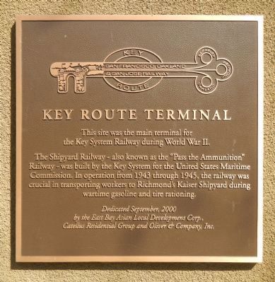
Key Route Terminal
the Key System Railway during World War II.
The Shipyard Railway – also known as the “Pass the Ammunition”
Railway – was built by the Key System for the United States Maritime
Commission. In operation from 1943 through 1945, the railway was
crucial in transporting workers to Richmond’s Kaiser Shipyard during
wartime gasoline and tire rationing.
Erected 2000 by East Bay Asian Local Development Corp., Catellus Residential Group and Oliver & Company, Inc.
Topics. This historical marker is listed in these topic lists: Roads & Vehicles • War, World II. A significant historical year for this entry is 1943.
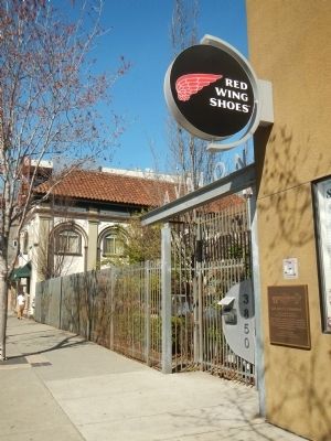
Location. 37° 49.798′ N, 122° 16.762′ W. Marker is in Emeryville, California, in Alameda County. Marker is on San Pablo Avenue, on the right when traveling north. Touch for map. Marker is at or near this postal address: 3850 San Pablo Avenue, Pinole CA 94564, United States of America. Touch for directions.
Other nearby markers. At least 8 other markers are within walking distance of this marker. Oakland Ball Park (approx. 0.2 miles away); Moving Shoreline (approx. half a mile away); Sherwin-Williams (approx. 0.6 miles away); Welcome to the Emeryville Greenway (approx. 0.6 miles away); Xučyun Park (Huchiun Park) (approx. 0.6 miles away); Judson Manufacturing (approx. 0.6 miles away); Two Emeryville Pioneers (approx. 0.6 miles away); PCR Park (approx. 0.7 miles away). Touch for a list and map of all markers in Emeryville.
Also see . . . Key System. Oakland Wiki entry:
The Key System (1903–1960) was a privately-owned transit system serving Alameda and Contra Costa counties. It was established by local businessmen F.M. “Borax” Smith and Frank C. Havens, who also ran the Realty Syndicate, a major property developer in early Oakland. (Submitted on March 18, 2014, by Barry Swackhamer of Brentwood, California.)
Credits. This page was last revised on July 9, 2022. It was originally submitted on March 18, 2014, by Barry Swackhamer of Brentwood, California. This page has been viewed 710 times since then and 31 times this year. Photos: 1, 2. submitted on March 18, 2014, by Barry Swackhamer of Brentwood, California. • Syd Whittle was the editor who published this page.

