Near Verbena in Chilton County, Alabama — The American South (East South Central)
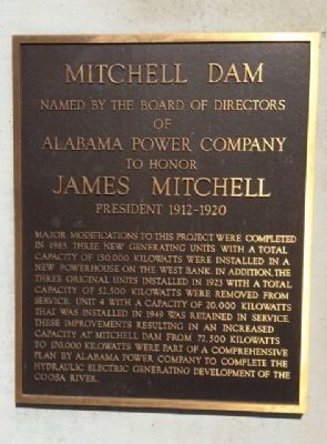
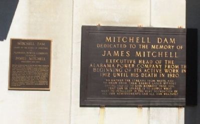
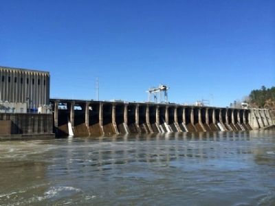
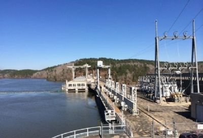
Mitchell Dam
of
Alabama Power Company
to honor
James Mitchell
President 1912-1920
Major modifications to this project were completed in 1985. Three new generating units with a total capacity of 150,000 kilowatts were installed in a new powerhouse on the west bank. In addition, the three additional units installed in 1923 with a total capacity of 52,500 kilowatts were removed from service. Unit 4 with a capacity of 20,000 kilowatts that was installed in 1949 was retained in service. These improvements resulting in an increased capacity at Mitchell Dam from 72,500 kilowatts to 170,000 kilowatts were part of a comprehensive plan by Alabama Power Company to complete the hydraulic electric generating developments of the Coosa River.
Erected 1923 by the Alabama Power Company.
Topics. This historical marker is listed in these topic lists: Industry & Commerce • Waterways & Vessels. A significant historical year for this entry is 1985.
Location. 32° 48.289′ N, 86° 26.792′ W. Marker is near Verbena, Alabama, in Chilton County. Marker can be reached from Mitchell Dam Road, half a mile east of County Road 93. Touch for map. Marker is at or near this postal address: Mitchell Dam Road, Verbena AL 36091, United States of America. Touch for directions.
Other nearby markers. At least 8 other markers are within 6 miles of this marker, measured as the crow flies. Verbena, Alabama (approx. 5.3 miles away); Army Barracks for Enlisted Men (approx. 5.9 miles away); Woven Wire Fence (approx. 6 miles away); Site of "John E. Moore," "Camp Hardee," "Cottage Number 8" and "Cripple Creek Hotel" Cottages (approx. 6 miles away); Marbury Methodist Church (approx. 6 miles away); The Hospital (approx. 6 miles away); Water Tank (approx. 6 miles away); Memorial Hall Flagpole (approx. 6 miles away).
Credits. This page was last revised on April 13, 2023. It was originally submitted on March 21, 2014, by Mark Hilton of Montgomery, Alabama. This page has been viewed 768 times since then and 34 times this year. Photos: 1, 2, 3, 4. submitted on March 21, 2014, by Mark Hilton of Montgomery, Alabama. • Bernard Fisher was the editor who published this page.


