Near Spotsylvania Courthouse in Spotsylvania County, Virginia — The American South (Mid-Atlantic)
Warren's Line
The Battle of Spotsylvania Court House
Inscription.
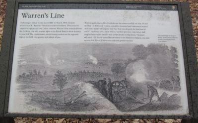
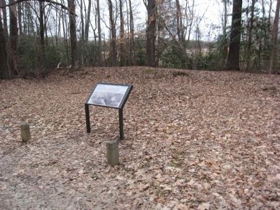
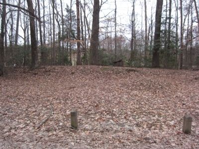
Following its failure to take Laurel Hill on May 8, 1864, General Gouverneur K. Warren's Fifth Corps entrenched here. This crescent-shape work protected two Union cannons. Warren's line extended from the Po River, one mile to your right, to the Brock Road, a short distance to your left. The Confederates held a strong position on the opposite edge of the field, one-quarter mile ahead of you.
Warren again attacked the Confederate line unsuccessfully on May 10 and on May 12. With each repulse, casualties mounted and enthusiasm waned. "It is not a matter of surprise that they had lost all spirit for that kind of work," explained one Union officer, "as their previous experience had taught them that to [attack] was certain death on that front." Stymied at Laurel Hill, Grant turned his attention to the Muleshoe Salient, one mile to your left. There, Union arms enjoyed greater success.
Erected by National Park Service, U.S. Department of the Interior.
Topics. This historical marker is listed in this topic list: War, US Civil. A significant historical month for this entry is May 1850.
Location. 38° 12.94′ N, 77° 37.126′ W. Marker is near Spotsylvania Courthouse, Virginia, in Spotsylvania County. Marker is on Hancock Road, on the left when traveling south. Marker is located west of the Spotsylvania Exhibit Shelter, along the Laurel Hill trail. Touch for map. Marker is at or near this postal address: 8204 Brock Rd, Spotsylvania VA 22553, United States of America. Touch for directions.
Other nearby markers. At least 8 other markers are within walking distance of this marker. Spindle House (approx. 0.2 miles away); Spotsylvania Campaign (approx. 0.2 miles away); a different marker also named The Spindle House (approx. 0.2 miles away); Laurel Hill (approx. ¼ mile away); The Race for Spotsylvania Court House (approx. ¼ mile away); The Death of Sedgwick (approx. 0.3 miles away); Sedgwick (approx. 0.3 miles away); Laurel Hill Trail (approx. 0.3 miles away). Touch for a list and map of all markers in Spotsylvania Courthouse.
Credits. This page was last revised on July 9, 2021. It was originally submitted on April 7, 2014, by Craig Swain of Leesburg, Virginia. This page has been viewed 581 times since then and 15 times this year. Photos: 1, 2, 3. submitted on April 7, 2014, by Craig Swain of Leesburg, Virginia.


