Port Royal in King George County, Virginia — The American South (Mid-Atlantic)
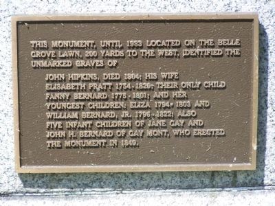
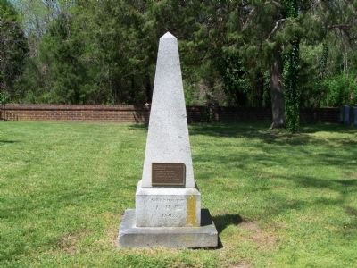
This monument, until 1983 located on the Belle Grove Lawn
200 yards to the west, identified the unmarked graves of
Inscription.
John Hipkins, died 1804; his wife Elisabeth Pratt 1754-1829; their only child Fanny Bernard 1774-1801; and her youngest children; Eliza 1794-1803 and William Bernard, Jr. 1796-1822; also five infant children of Jane Gay and John H. Bernard of Gay Mont, who erected the monument in 1849.
Topics. This historical marker is listed in this topic list: Cemeteries & Burial Sites. A significant historical year for this entry is 1804.
Location. 38° 10.77′ N, 77° 11.168′ W. Marker is in Port Royal, Virginia, in King George County. Marker can be reached from US 301 James Madison Parkway. Monument is in Emmanuel Episcopal Cemetery. Touch for map. Marker is in this post office area: Port Royal VA 22535, United States of America. Touch for directions.
Other nearby markers. At least 8 other markers are within walking distance of this marker. Emmanuel Episcopal Church (within shouting distance of this marker); Emmanuel Church (within shouting distance of this marker); James Madison's Birthplace (within shouting distance of this marker); King George County / Caroline County (within shouting distance of this marker); Port Royal Harbor (approx. half a mile away); Port Royal (approx. half a mile away); a different marker also named Port Royal (approx. half a mile away); Dorothy Roy (approx. 0.6 miles away). Touch for a list and map of all markers in Port Royal.
Credits. This page was last revised on December 25, 2019. It was originally submitted on April 23, 2008, by Bill Pfingsten of Bel Air, Maryland. This page has been viewed 1,919 times since then and 22 times this year. Photos: 1, 2, 3. submitted on April 23, 2008, by Bill Pfingsten of Bel Air, Maryland.


