Northern Waterfront in San Francisco City and County, California — The American West (Pacific Coastal)
Discarded Treasure
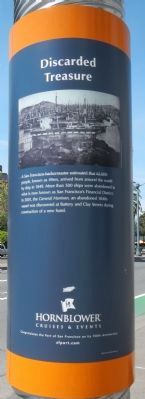
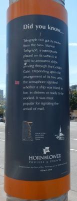
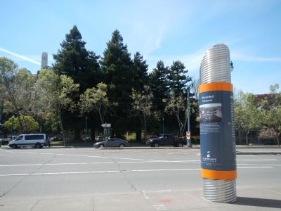
This marker is one of a series intended to commemorate the 150 years of the Port of San Francisco. It is composed of a captioned photograph and text entitled Did you know... mounted on a cylindrical metal pylon.
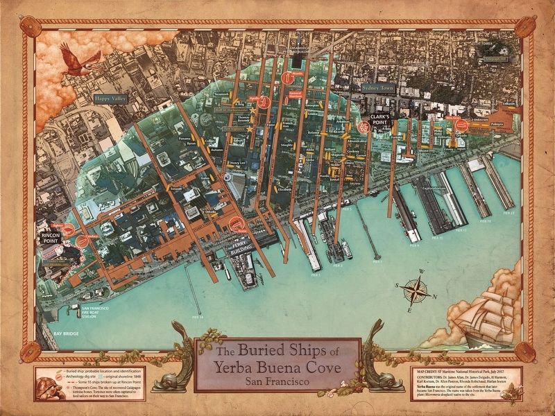
A San Francisco harbormaster estimated that 62,000 people, known as 49ers, arrived from around the world by ship in 1849. More than 500 ships were abandoned in what is now known as San Francisco’s Financial District. In 2001, the General Harrison, an abandoned 1840s vessel was discovered at Battery and Clay Streets during construction of a new hotel.
Did you know...
Telegraph Hill got its name from the New Marine Telegraph, a semaphore placed on it summit in 1850 to announce ships arriving through the Golden Gate. Depending upon the arrangements of its two arms, the semaphore signaled whether a ship was friend or foe, in distress or ready to be worked. It was most popular for signaling the arrival of mail.
150 Years
1863 – 2013
“Where the City meets the Bay”
Erected 2013 by Port of San Francisco.
Topics. This historical marker is listed in this topic list: Waterways & Vessels. A significant historical year for this entry is 1849.
Location. 37° 48.324′ N, 122° 24.198′ W. Marker is in San Francisco, California, in San Francisco City and County. It is in Northern Waterfront. Marker is on The Embarcadero near Sansome Street, on the left when traveling east. Touch for map. Marker is at or near this postal address: 1620 The Embarcadero, San Francisco CA 94105, United States of America. Touch for directions.
Other nearby markers. At least 8 other markers are within walking distance of this marker. Down to the Sea in Ships (within shouting distance of this marker); Belt Line Railroad (within shouting distance of this marker); Francisco Street (about 400 feet away, measured in a direct line); Barracks/Apartments (about 500 feet away); The Dock (about 500 feet away); Staff Housing Area (about 500 feet away); Guardhouse & Sallyport Complex (about 500 feet away); Warden’s House and Lighthouse (about 500 feet away). Touch for a list and map of all markers in San Francisco.
More about this marker. This marker is located near Pier 31 on Herb Caen Way.
Also see . . .
1. Buried Ships. sfGeneology website entry:
During the Gold Rush of 1849 and 1850s there were no railroads, airplanes, or automobiles. The fastest mode of transportation to the first stop for the gold fields, San Francisco, was aboard a vessel. By the summer of 1850, over 500 vessels were recorded as being anchored in the vicinity of Yerba Buena Cove. After they had arrived, whole crews abandoned their ships, along with the passengers, to make their way up to the gold fields. (Submitted on April 22, 2014, by Barry Swackhamer of Brentwood, California.)
2. Buried ships in San Francisco. National Parks Service, San Francisco Maritime National Historical Park website entry (Submitted on April 12, 2021, by Larry Gertner of New York, New York.)
Additional keywords. California Gold Rush
Credits. This page was last revised on February 7, 2023. It was originally submitted on April 22, 2014, by Barry Swackhamer of Brentwood, California. This page has been viewed 513 times since then and 21 times this year. Photos: 1, 2, 3. submitted on April 22, 2014, by Barry Swackhamer of Brentwood, California. 4. submitted on April 12, 2021, by Larry Gertner of New York, New York. • Bill Pfingsten was the editor who published this page.


