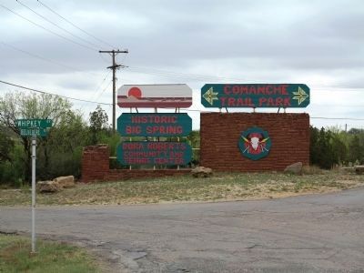
Big Spring in Howard County, Texas — The American South (West South Central)
Route of Marcy’s Trail
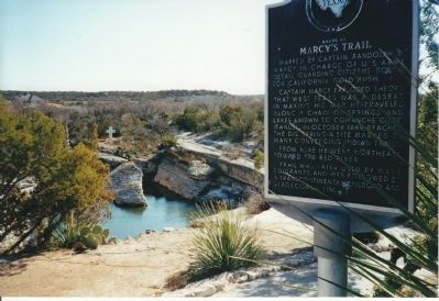
Inscription.
Mapped by Captain Randolph B. Marcy in charge of U.S. Army detail guarding citizens bound for California Gold Rush.
Captain Marcy exploded theory that West Texas was a desert. In making his map, he traveled along a chain of springs and lakes known to Comanche guide Manuel. In October 1849, reached the Big Spring - a site marked by many converging Indian trails.
From here he went northeast toward the Red River.
Trail was later used by many emigrants, and was followed by a transcontinental railroad and stagecoach line.
Erected 1966 by State Historical Survey Committee. (Marker Number 15634.)
Topics and series. This historical marker is listed in this topic list: Roads & Vehicles. In addition, it is included in the Comanche Trail into Mexico series list. A significant historical month for this entry is October 1849.
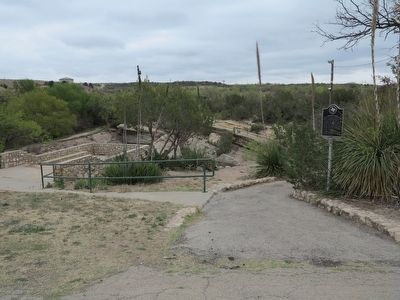
Location. 32° 13.168′ N, 101° 28.535′ W. Marker is in Big Spring, Texas, in Howard County. Marker is on Belvedere Road, 0.2 miles south of Whipkey Drive. Marker is in the park. Located along the Comanche Trail Walking Path. Touch for map. Marker is in this post office area: Big Spring TX 79720, United States of America. Touch for directions.
Other nearby markers. At least 8 other markers are within 3 miles of this marker, measured as the crow flies. Big Spring State Park on Route of Old Comanche War Trail (approx. 0.8 miles away); Big Spring School District (approx. 2 miles away); First Christian Church (approx. 2 miles away); First National Bank in Big Spring (approx. 2.2 miles away); Howard County (approx. 2.2 miles away); Potton House (approx. 2.3 miles away); Settles Hotel (approx. 2.3 miles away); The Seventh Earl of Aylesford (approx. 2.3 miles away). Touch for a list and map of all markers in Big Spring.
Related marker. Click here for another marker that is related to this marker.
Also see . . . BGen Randolph Barnes Marcy, U.S. Army. (Submitted on May 8, 2011, by Richard E. Miller of Oxon Hill, Maryland.)
Additional commentary.
1. Comanche Trail
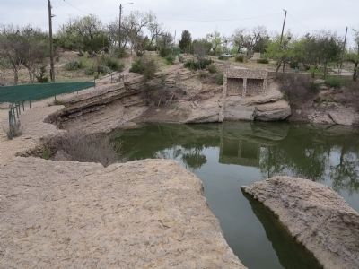
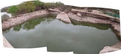
Big Spring was an important watering hole on the Comanche Trail from about 1750 to 1875. Marcy reported that paths from northeast, north and northwest converged here on the springs. Note To Editor only visible by Contributor and editor
— Submitted March 7, 2012, by Richard Denney of Austin, Texas.
Additional keywords.
Comanche trail, Comanche war trail
Credits. This page was last revised on June 16, 2016. It was originally submitted on February 13, 2010, by Richard Denney of Austin, Texas. This page has been viewed 2,811 times since then and 58 times this year. Last updated on April 29, 2014, by Richard Denney of Austin, Texas. Photos: 1. submitted on April 29, 2014, by Richard Denney of Austin, Texas. 2. submitted on February 13, 2010, by Richard Denney of Austin, Texas. 3, 4, 5, 6. submitted on April 29, 2014, by Richard Denney of Austin, Texas. • Bill Pfingsten was the editor who published this page.

