Arnoldsburg in Calhoun County, West Virginia — The American South (Appalachia)
Engagement at Arnoldsburg
Divided Loyalties
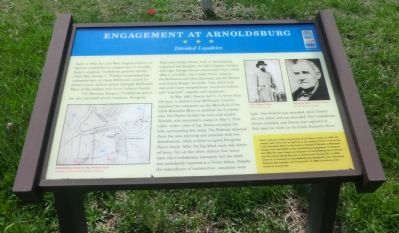
The Moccasin Rangers, Confederate guerillas, also recruited county residents. Peregrine Hays and George Silcott, both of Arnoldsburg, organized the Rangers, the 19th Virginia Cavalry, and Capt. George Downs commanded them. From 1861 to mid-1862, they raided Union outposts, the Baltimore and Ohio Railroad, and the Weston and Gauley Bridge Turnpike. They killed and captured Union sympathizers, recruited soldiers, and “acquired” supplies and equipment.
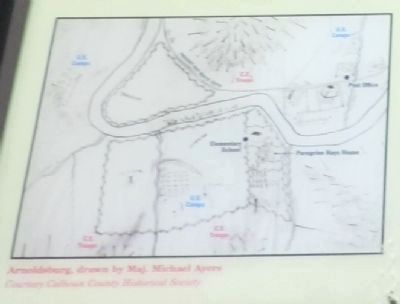
In May 1862, Downs led Co. A, fewer than 100 men, to attack Camp McDonald. Trimble marched two companies up the West Fork of the Little Kanawha River to confront the Confederates, but Downs divided his force and eluded Trimble, who returned to camp on May 5. That night, under cover of fog, Downs occupied the hills surrounding the camp. The Federals detected them the next morning and attacked with two detachments, while a third occupied Peregrine Hay’s house. After the fog lifted, each side directed heavy fire on the other. Almost four hours later, the Confederates retreated, but the clash was mistakenly reported as a Union defeat. Despite the expenditure of ammunition, casualties were light. One Federal was wounded, while Downs lost two killed and one wounded. The Confederate threat subsided, and Downs was captured in July near his home on the Little Kanawha River.
(sidebar)
When Calhoun County was formed from Gilmer County in 1856, the county court first met on April 14 at the mouth of the Pine Creek on the Little Kanawha River in the house of Joseph W. Burson, a Moccasin Ranger who was killed in the Arnoldsburg engagement. In September 1856, the court began meeting here in Arnoldsburg, but in November the voters moved the seat to present-day Brooksville. In 1858, however, it returned to Arnoldsburg and during the war, alternated between this location and Grantsville. In 1869, it settled permanently in Grantsville.
(captions)
(lower left) Arnoldsburg, drawn by Maj. Michael Ayers Courtesy Calhoun County Historical Society
(upper right) Capt. George Downs Courtesy Ken Connell, Peregrine Hays — Courtesy Calhoun County Historical Society
Erected by West Virginia Civil War Trails.
Topics and series. This historical marker is listed in this topic list: War, US Civil
. In addition, it is included in the West Virginia Civil War Trails series list. A significant historical month for this entry is April 1986.
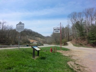
Location. 38° 47.643′ N, 81° 8.502′ W. Marker is in Arnoldsburg, West Virginia, in Calhoun County. Marker is at the intersection of Arnoldsburg Road (U.S. 33/119) and County Route 33/119, on the right when traveling west on Arnoldsburg Road. Marker is located in West Fork Park. Touch for map. Marker is in this post office area: Arnoldsburg WV 25234, United States of America. Touch for directions.
Other nearby markers. At least 8 other markers are within 10 miles of this marker, measured as the crow flies. Arnoldsburg Skirmish (here, next to this marker); Perry Hays & George Silcott / Louisa Hays & Amie Silcott (a few steps from this marker); Moccasin Rangers (a few steps from this marker); Honoring E. Dean Starcher (approx. 5.7 miles away); Grave of Mike Fink (approx. 5.9 miles away); Gilmer County / Calhoun County (approx. 7.7 miles away); Calhoun County Veterans Memorial (approx. 9.3 miles away); In Memoriam CSM Clovis Drexell Ice (approx. 9.3 miles away). Touch for a list and map of all markers in Arnoldsburg.
Credits. This page was last revised on June 16, 2016. It was originally submitted on May 4, 2014, by Don Morfe of Baltimore, Maryland. This page has been viewed 730 times since then and 45 times this year. Photos: 1, 2, 3. submitted on May 4, 2014, by Don Morfe of Baltimore, Maryland. • Bernard Fisher was the editor who published this page.


