Honolulu in Honolulu County, Hawaii — Hawaiian Island Archipelago (Pacific Ocean)
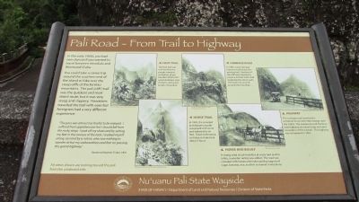
Pali Road – From Trail to Highway
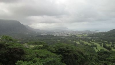
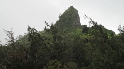
You could take a canoe trip around the southern end of the island or hike over the steep cliffs of the Ko’olau mountains. The pali (cliff) trail was the quickest and most direct route, but it was very steep and slippery. Hawaiians travelled the trail with ease but foreigners had a very different experience:
“The pass was almost too fearful to be enjoyed. I suffered from apprehension lest I should fall from the rocky steep. I took off my shoes and by setting my feet in the crevices of the rock, I worked myself along, assisted by a native, who saw nothing to wonder at by my awkwardness and fear on passing this grand highway.”
Reverend Reuben Tinker, 1831
Foot Trail
The foot trail was well travelled by people carrying containers of poi, bundles of taro and sweet potatoes, pigs, chickens, and goats to sell in Honolulu.
Carriage Road
In 1897, a new carriage road was built below the existing trail. Portions of the cliff were blasted to create a 20 foot wide road supported by stone walls. The road now would around the mountain.
Horse Trail
In 1845, the crowed and dangerous path was paved with stone and widened to six feet. Travel to Honolulu on horse or mule took about 3 hours.
Horse and Buggy
A strong wind struck travelers at every turn and for safety, a wooden railing was added. The road was crowded with horse and mule pulling wagons of sugar, bananas, rice, and fish to market in Honolulu.
Highway
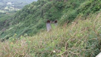
The carriage road handled the transition to car with little change until the 1950’s. The construction of the four-lane highway we travel today included excavation of the tunnels. This highway was completed in 1957.
Erected by State of Hawai’i/Department of Land and Natural Resources/Division of State Parks.
Topics. This historical marker is listed in this topic list: Roads & Vehicles. A significant historical year for this entry is 1831.
Location. 21° 22.023′ N, 157° 47.578′ W. Marker is in Honolulu, Hawaii, in Honolulu County. Marker is on Nuuanu Pali Drive, on the right when traveling north. Located at Nu’uanu Pali State Wayside Park on Pali Highway 61. Touch for map. Marker is at or near this postal address: Nuuanu Pali Drive, Honolulu HI 96815, United States of America. Touch for directions.
Other nearby markers. At least 8 other markers are within 6 miles of this marker, measured as the crow flies. Nuuanu Pali Lookout (a few steps from this marker); Battle of Nu’uanu – Uniting the Islands (a few steps from this marker); Pali Road (within shouting distance of this marker); The Honolulu Memorial at the National Memorial Cemetery of the Pacific (approx. 5.1 miles away); He Ho‘Omana‘o (approx. 5.3 miles away); Pohakuloa Amtrac Memorial (approx. 5.4 miles away); Father Damien (approx. 5.8 miles away); Iolani Palace (approx. 6 miles away). Touch for a list and map of all markers in Honolulu.
Credits. This page was last revised on June 16, 2016. It was originally submitted on May 9, 2014, by Denise Boose of Tehachapi, California. This page has been viewed 528 times since then and 42 times this year. Photos: 1, 2, 3, 4, 5, 6, 7. submitted on May 9, 2014, by Denise Boose of Tehachapi, California. • Bill Pfingsten was the editor who published this page.
