Marshall in Marin County, California — The American West (Pacific Coastal)
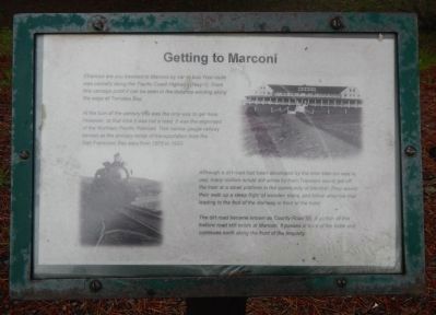
Getting to Marconi
At the turn of the century this was the only way to get here. However, at the time it was the alignment of the Northern Pacific Railroad. This narrow gauge railway served as the primary mode of transport from the San Francisco Bay area from 1875 to 1933.
Although a dirt road had been developed by the time Marconi was in use, many visitors would still arrive by train at a small platform in the community of Marshall. They would then walk up a steep flight of wooden stairs, and follow a narrow trail leading to the foot of a stairway in front of the hotel.
The dirt road became known as County Road 57. A portion of this historic road still exists at Marconi. It passes in front of the hotel and continues north along the front of the property.
Topics. This historical marker is listed in these topic lists: Railroads & Streetcars • Roads & Vehicles. A significant historical year for this entry is 1875.
Location. 38° 8.617′ N, 122° 52.62′ W. Marker is in Marshall, California, in Marin County. Marker can be reached from Pacific Coast Highway (California Route 1), on the right when traveling north. Touch for map. Marker is at or near this postal address: 18500 California Highway 1, Marshall CA 94940, United States of America. Touch for directions.
Other nearby markers. At least 8 other markers are within 8 miles of this marker, measured as the crow flies. Beryl and Leonard Buck Hall (within shouting distance of this marker); AT&T & RCA Receiving Stations (approx. 5.2 miles away); Providing Global Communications (approx. 5.2 miles away); Warren Dutton House - Tomales Community Park (approx. 7.2 miles away); Tomales Presbyterian Church (approx. 7.2 miles away); Tomales (approx. 7.2 miles away); Tomales Town Hall (approx. 7.3 miles away); Drakes Bay (approx. 8 miles away).
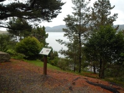
More about this marker. This marker is located on the grounds of the Marconi Conference Center State Historic Park across from the Beryl and Leonard Buck Hall.
Credits. This page was last revised on June 16, 2016. It was originally submitted on May 16, 2014, by Barry Swackhamer of Brentwood, California. This page has been viewed 481 times since then and 14 times this year. Photos: 1, 2. submitted on May 16, 2014, by Barry Swackhamer of Brentwood, California. • Bill Pfingsten was the editor who published this page.

