Chester in Chesterfield County, Virginia — The American South (Mid-Atlantic)
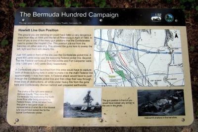
Howlett Line Gun Position
The Bermuda Hundred Campaign
Just 100 yards in front of this site was the Confederate picket line. A mere 600 yards away was the opposing Federal picket line. Beyond that the Federal cannons at Fort McConihe and Fort Carpenter were only 1,000 and 1,400 yards away respectively.
A Confederate attack launched from this area would have to capture both of those outlying forts in order to make it to the main Federal line approximately 1 mile from here. A Federal attack would have to push through the Confederate picket line and then chop their way through three lines of obstructions, all while under heavy fire from the guns here and Confederate riflemen behind well prepared earthworks.
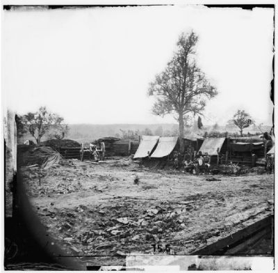
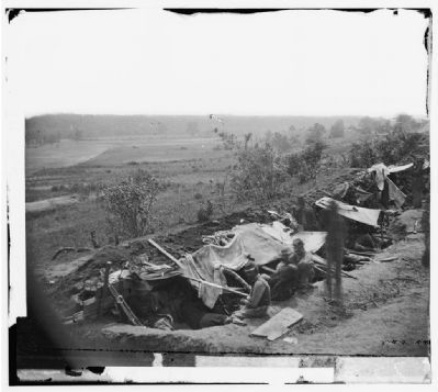
The photos to the right were taken in Hanover County. They show the Confederate line overlooking the North Anna River after being occupied by Federal troops. While not taken here, they give a very good visual representation of what life in the Howlett Line would have looked like for the typical Confederate soldier.
(captions)
The gun position in front of you would have looked very similar to the one in this photo.
Makeshift shelters in the trenches.
This sign was sponsored by Jessica and Harry Thaete, Coronado, CA
Erected 2014 by Chesterfield County and the Blue & Gray Education Society.
Topics. This historical marker is listed in this topic list: War, US Civil. A significant historical month for this entry is April 1865.
Location. 37° 20.677′ N, 77° 23.527′ W. Marker is in Chester, Virginia, in Chesterfield County. Marker can be reached from Old Bermuda Hundred Road east of Ramblewood Drive, on the right when traveling east. Located in Ware Bottom Church Battlefield Park. Touch for map. Marker is at or near this postal address: 1600 Old Bermuda Hundred Rd, Chester VA 23831, United States of America. Touch for directions.
Other nearby markers. At least 8 other markers are within walking distance of this marker. Construction of the Howlett Line (about 400 feet away, measured in a direct line); A Bomb Proof Church ? (approx. 0.2 miles away); The Battle of Ware Bottom Church (approx. 0.2 miles away); Parker's Battery (approx. 0.3 miles away); Remembrance (approx. 0.3 miles away); a different marker also named Parker’s Battery (approx. 0.3 miles away); Howlett Line (approx. 0.4 miles away); a different marker also named Howlett Line (approx. 0.4 miles away). Touch for a list and map of all markers in Chester.
Credits. This page was last revised on January 9, 2020. It was originally submitted on May 25, 2014, by Bernard Fisher of Richmond, Virginia. This page has been viewed 847 times since then and 21 times this year. Photos: 1, 2. submitted on May 25, 2014, by Bernard Fisher of Richmond, Virginia. 3, 4. submitted on June 1, 2014, by Bernard Fisher of Richmond, Virginia.


