Near Saluda in Gloucester County, Virginia — The American South (Mid-Atlantic)
Middlesex County / Gloucester County
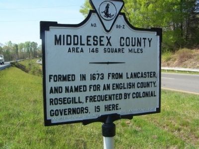
Middlesex County. Area 146 Square Miles. Formed in 1673 from Lancaster, and named for an English County. Rosegill, frequented by colonial governors, is here.
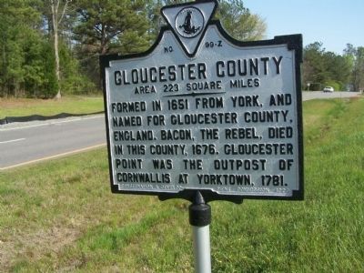
Gloucester County. Area 223 Square Miles. Formed in 1651 from York, and named for Gloucester County, England, Bacon, the rebel, died in this county, 1676. Gloucester Point was the outpost of Cornwallis at Yorktown, 1781.
Erected 1928 by Conservation Development Commission. (Marker Number Z-99.)
Topics and series. This historical marker is listed in these topic lists: Colonial Era • Settlements & Settlers • War, US Revolutionary. In addition, it is included in the Virginia Department of Historic Resources (DHR) series list. A significant historical year for this entry is 1673.
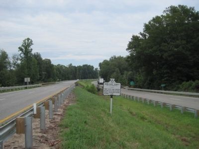
Location. 37° 35.083′ N, 76° 36.195′ W. Marker is near Saluda, Virginia, in Gloucester County. Marker is on George Washington Memorial Highway (U.S. 17), in the median. Marker is at county line. Touch for map. Marker is at or near this postal address: 15609 George Washington Memorial Hwy, Saluda VA 23149, United States of America. Touch for directions.
Other nearby markers. At least 8 other markers are within 3 miles of this marker, measured as the crow flies. Middlesex County Courthouse (approx. 1.6 miles away); Middlesex County Confederate Monument (approx. 1.6 miles away); Morgan v. Virginia (approx. 1.6 miles away); 1st Lt Beryl R. Newman (approx. 1.6 miles away); Middlesex County Veteran's Memorial (approx. 1.6 miles away); Veterans Memorial (approx. 1.6 miles away); Christ Church (approx. 2.3 miles away); Scottish Factors Store (approx. 2.3 miles away). Touch for a list and map of all markers in Saluda.
Credits. This page was last revised on July 7, 2021. It was originally submitted on April 27, 2008, by Bill Pfingsten of Bel Air, Maryland. This page has been viewed 1,097 times since then and 25 times this year. Photos: 1, 2. submitted on April 27, 2008, by Bill Pfingsten of Bel Air, Maryland. 3. submitted on July 27, 2010, by Kevin W. of Stafford, Virginia.


