Crieve Hall in Nashville in Davidson County, Tennessee — The American South (East South Central)
Travellers Rest
"The proudest moment of my life"
— Hood's Campaign —
(main text)
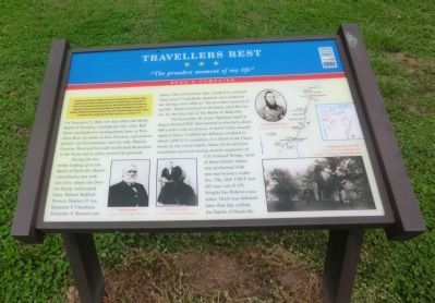
On December 2, 1864, two days after the bloody Battle of Franklin, Confederate Gen. John Bell Hood established his headquarters here at Travellers Rest, the home of John Overton, a prominent planter and businessman, and his wife, Harriet Overton. Hood and his staff established themselves in the house and in tents around the grounds.
During the two weeks leading up to the Battle of Nashville, Hood’s subordinates met with him here, where the Overton family entertained Gens. Nathan Bedford Forrest, Stephen D. Lee, Benjamin F. Cheatham, Alexander P. Stewart and others. Harriet Overton later recalled an occasion when seven Confederate generals were seated at her dining room table as “the proudest moment of my life.” Hood remained at the house until December 15, the first day of the Battle of Nashville.
On December 16, heavy fighting raged at Peach Orchard Hill, then located on the farm about 600 yards to the northwest. A failed Union assault against heavy Confederate defenses resulted in about 1,000 U.S. casualties, or a third of the Union losses in the entire battle. Some of the heaviest casualties occurred among several regiments of U.S. Colored Troops, most of them former slaves, who performed with extreme bravery under fire. The 13th USCT lost 221 men out of 470. Despite the Federal casualties, Hood was defeated later that day, ending the Battle of Nashville.
(captions)
(lower left) John Overton and Harriet Overton Courtesy Travellers Rest Plantation
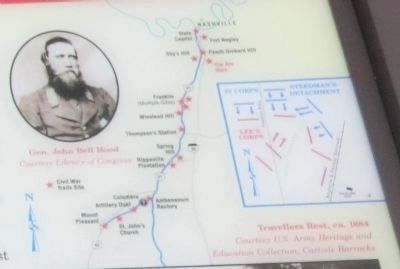
(upper right) Gen. John Bell Hood Courtesy Library of Congress
(lower right) Travellers Rest, ca. 1884 Courtesy U.S. Army Heritage and Education Collection, Carlisle Barracks
Erected by Tennessee Civil War Trails.
Topics and series. This historical marker is listed in this topic list: War, US Civil. In addition, it is included in the Tennessee Civil War Trails series list. A significant historical month for this entry is September 1864.
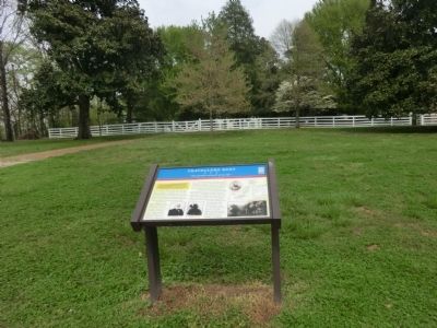
Location. 36° 4.576′ N, 86° 45.885′ W. Marker is in Nashville, Tennessee, in Davidson County. It is in Crieve Hall. Marker can be reached from Farrell Parkway, half a mile east of Franklin Pike (U.S. 31), on the left when traveling east. Located in the parking lot of the Historic Travellers Rest Plantation & Museum. Touch for map. Marker is at or near this postal address: 636 Farrell Parkway, Nashville TN 37220, United States of America. Touch for directions.
Other nearby markers. At least 8 other markers are within 2 miles of this marker, measured as the crow flies. Battle of Nashville / Peach Orchard Hill (within shouting distance of this marker); a different marker also named Travellers' Rest (approx. 0.2 miles away); Battle of Nashville (approx. 0.7 miles away); a different marker also named Battle of Nashville (approx. 0.7 miles away); Robertson Academy (approx. ¾ mile away); Crieve Hall (approx. 0.9 miles away); a different marker also named Battle of Nashville (approx. one mile away); Ellington Agricultural Center (approx. 1.2 miles away). Touch for a list and map of all markers in Nashville.
Credits. This page was last revised on February 7, 2023. It was originally submitted on June 13, 2014, by Don Morfe of Baltimore, Maryland. This page has been viewed 921 times since then and 12 times this year. Photos: 1, 2, 3. submitted on June 13, 2014, by Don Morfe of Baltimore, Maryland. • Bernard Fisher was the editor who published this page.


