Auburn in Lee County, Alabama — The American South (East South Central)
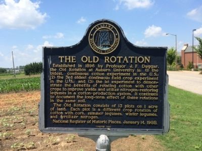
The Old Rotation
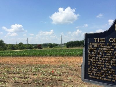
The Old Rotation consists of 13 plots on 1 acre of land. Each plot is a different crop rotation of cotton with corn, summer legumes, winter legumes, and fertilizer nitrogen.
National Register of Historic Places, January 14, 1988.
Erected 1988 by the Alabama Historical Commission.
Topics and series. This historical marker is listed in these topic lists: Agriculture • Education • Horticulture & Forestry. In addition, it is included in the Alabama Historical Commission series list. A significant historical date for this entry is January 14, 1908.
Location. 32° 35.624′ N, 85° 29.149′ W. Marker is in Auburn, Alabama, in Lee County. Marker is on Lem Morrison Drive, 0.1 miles north of Duncan Drive, on the right when traveling north. Touch for map. Marker is in this post office area: Auburn University AL 36849, United States of America. Touch for directions.
Other nearby markers. At least 8 other markers are within walking distance of this marker. Founders' Oak (approx. ¼ mile away); Auburn University and the Alabama Farmers Federation (approx. 0.3 miles away); Advancing American Art Collection (approx. 0.4 miles away); The Cullars Rotation / The Alvis Field and Cotton Rust (approx. 0.4 miles away); Pine Hill Cemetery (approx. 0.7 miles away); Desegregation at Auburn (approx. 0.7 miles away); Auburn University (approx. ¾ mile away); Auburn WWI Memorial (approx. ¾ mile away). Touch for a list and map of all markers in Auburn.
Also see . . . Alabama's "Old Rotation" Experiment. Encyclopedia of Alabama entry. (Submitted on June 15, 2014, by Mark Hilton of Montgomery, Alabama.)
Credits. This page was last revised on August 29, 2020. It was originally submitted on June 15, 2014, by Mark Hilton of Montgomery, Alabama. This page has been viewed 802 times since then and 32 times this year. Photos: 1, 2, 3. submitted on June 15, 2014, by Mark Hilton of Montgomery, Alabama. • Bernard Fisher was the editor who published this page.


