Lockport in Niagara County, New York — The American Northeast (Mid-Atlantic)
The Erie Barge Canal at Lockport
Inscription.
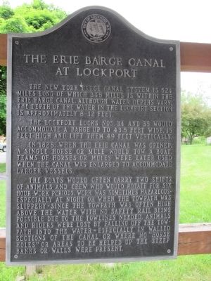
The New York State Barge Canal System is 524 miles long of which 348 miles is within the Erie Barge Canal. Although water depths vary, the depth of the water in the Lockport section is approximately 8 - 12 feet.
The Lockport Locks Nos. 34 and 35 would accommodate a barge up to 43.5 feet wide, 15 feet high and lift them 49 feet vertically.
In 1825, when the Erie Canal was opened, a single horse or mule would tow a boat. Teams of horses or mules were later used when the canal was enlarged to accommodate larger vessels.
The boats would often carry two shifts of animals and crew who would rotate for six hour work periods. Work was sometimes hazardous - especially at night or when the towpath was slippery - since the towpath was often high above the water with no safety rail being possible due to the tow lines needed. Animals and riders were lost by falling off the towpath into the water - especially in walled sections of the canal or where no "horse holes" or areas to be helped up the steep banks or walls were present.
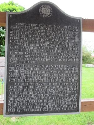
Strong winds could hold an empty boat against the bank or wall and make towing impossible and sinking boats would slow down other traffic. Sinking boats that were top-heavy would often capsize and dump their cargo; others went down cargo and all; grain boats would swell up and necessitate the use of dynamite and dredging. Concrete barges were tried experimentally, but minor accidents created holes or cracks that were difficult to mend and they sank decisively. Salvage, pumping, dredging and towing to drydocks were critical operations to maintain the flow of traffic.
Commercial enterprises were present along the canal with stores and shops built as close to the towpath as possible. Farmers with produce stands, grocers, and other merchants selling goods and supplies all contended for the potential business offered by passing vessels.
Although the commercial traffic has passed its prime on the canal, recreational use of the waterway is estimated at 55,000 pleasure craft per year, and the towpath provides many miles of hiking or bicycling potential. The "widewaters" in the canal - previously used as a boat turnaround - has provided areas for marinas in Lockport and other cities and villages. Much of the adjacent land along the canal offers pleasant use as park and greenspace for leisure activities.
Topics and series. This historical marker is listed in this topic list: Waterways & Vessels. In addition, it is included in the Erie Canal series list. A significant historical year for this entry is 1825.
Location. 43° 10.588′ N, 78° 41.126′ W. Marker is in Lockport, New York, in Niagara County. Marker
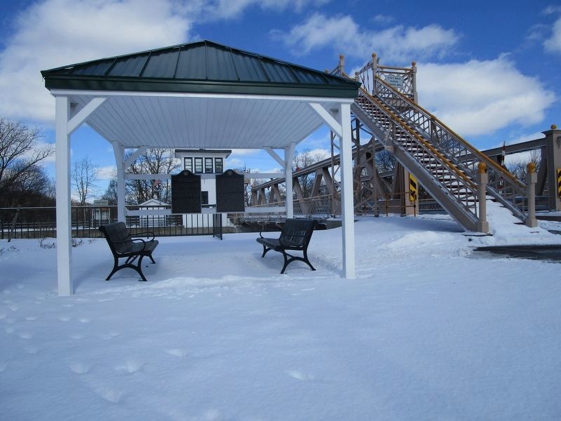
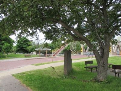
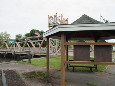
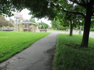
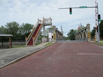
is at the intersection of Market Street and Exchange Street, on the right when traveling west on Market Street. This marker consists of two identically shaped and colored plaques next to each other to accomodate the lenghthy text. The marker is adjacent to the Exchange Street lift bridge, under a small open shelter. The marker faces the bridge approach. Touch for map. Marker is in this post office area: Lockport NY 14094, United States of America. Touch for directions.
Other nearby markers. At least 8 other markers are within walking distance of this marker. Aaron Mossell (within shouting distance of this marker); The Sluice and Hall Spillway (about 300 feet away, measured in a direct line); Lockport Bank (about 600 feet away); The Lowertown Historic District (approx. 0.2 miles away); Residence of Washington Hunt (approx. 0.2 miles away); a different marker also named The Lowertown Historic District (approx. 0.2 miles away); Lockport Federal Building (approx. 0.4 miles away); Barge Tie Ups & lock view looking west (approx. half a mile away). Touch for a list and map of all markers in Lockport.
Also see . . .
1. Erie Canal Discovery Center - Lockport, NY. Niagara County Historical Society website entry (Submitted on June 18, 2014, by Anton Schwarzmueller of Wilson, New York.)
2. Exchange Street Bridge. Historic Bridges website entry (Submitted on June 19, 2014, by Anton Schwarzmueller of Wilson, New York.)
Photographed By Anton Schwarzmueller, June 4, 2014
10. The Erie Barge Canal at Lockport, Exchange Street Lift Bridge
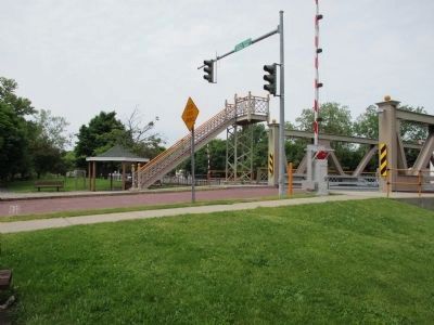
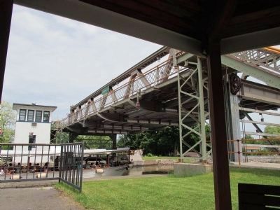
The lift bridge is raised for the boat Lockview IV carrying schoolchildren. Before the lift begins, traffic signals change, wooden gates descend, and a genuine bell is mechanically struck in even intervals. When this bridge was built, times of heavy canal traffic dictated that it be in the raised position more than the lowered position, hence the staircases at each end for pedestrian traffic to utilize the bridge while raised. View is from front of marker.
Photographed By Anton Schwarzmueller, June 4, 2014
13. Eastward View, Twin LIft Bridge
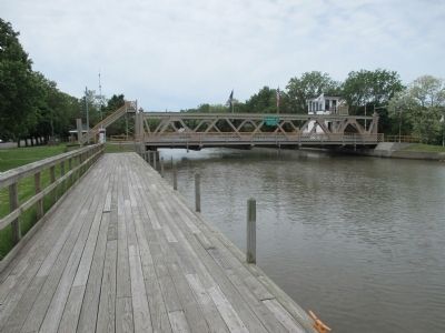
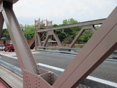
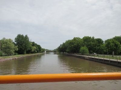
Looking east from the Exchange Street Bridge walkway, the twin Adams Street Bridge is in the distance. It is in need of mechanical restoration. It remains in the raised position to eliminante the risk of mechanical failure in the lowered position, which would block canal traffic. Canal towpath/dike at left; boardwalk at right.
Credits. This page was last revised on August 2, 2022. It was originally submitted on June 18, 2014, by Anton Schwarzmueller of Wilson, New York. This page has been viewed 653 times since then and 20 times this year. Photos: 1, 2. submitted on June 18, 2014, by Anton Schwarzmueller of Wilson, New York. 3. submitted on March 7, 2019, by Anton Schwarzmueller of Wilson, New York. 4, 5, 6, 7, 8, 9, 10, 11, 12, 13. submitted on June 18, 2014, by Anton Schwarzmueller of Wilson, New York. • Bill Pfingsten was the editor who published this page.
