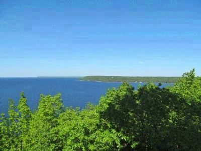
Near Fish Creek in Door County, Wisconsin — The American Midwest (Great Lakes)
A Road Less Traveled
Eagle Terrace
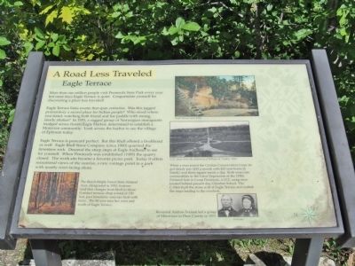
More than one million people visit Peninsula State Park every year but most days Eagle Terrace is quiet. Congratulate yourself for discovering a place less traveled!
Eagle Terrace links events that span centuries. Was this jagged promontory a sacred place for Indian people? Who stood where you stand, watching both friend and foe paddle with strong, steady strokes? In 1953 (sic), a ragged group of Norwegian immigrants trudged across frozen Eagle Harbor, determined to establish a Moravian community. Look across the harbor to see the village of Ephraim today.
Eagle Terrace is postcard perfect. But this bluff offered a livelihood as well. Eagle Bluff Stone Company (circa 1900) quarried the limestone rock. Descend the steep steps at Eagle trailhead to see for yourself. When Peninsula was established (1909) the quarry closed. The work site became a favorite picnic post. Today it offers sensational views of the sunrise, a rare vantage point in a park with mostly west-facing shore.
The Beech-Maple Forest State Natural Area, designated in 1952, features land that changes from bluff to shore. Forested terraces drop a total of 150 feet, past limestone outcrops lush with ferns. The 80-acre area lies west and south of Eagle Terrace.
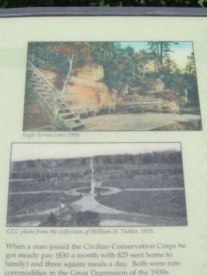
When a man joined the Civilian Conservation Corps he got steady pay ($30 a month with $25 sent home to family) and three square meals a day. Both were rare commodities in the Great Depression of the 1930s. Pictured here is Camp Peninsula, a CCC camp once located behind present day Gibraltar School. The C-Men built the stone wall at Eagle Terrace and crafted the steps leading to the overlook.
Reverend Andrew Iverson led a group of Moravians to Door County in 1853.
Topics and series. This historical marker is listed in these topic lists: Charity & Public Work • Industry & Commerce • Man-Made Features • Settlements & Settlers. In addition, it is included in the Civilian Conservation Corps (CCC) series list. A significant historical year for this entry is 1953.
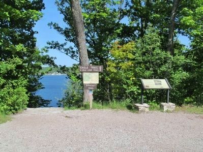
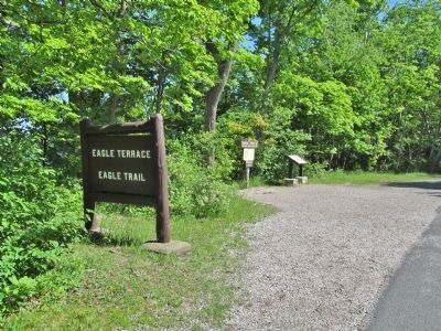
Location. 45° 9.607′ N, 87° 11.692′ W. Marker is near Fish Creek, Wisconsin, in Door County. Marker is on Eagle Terrace Road, 0.3 miles east of Shore Road, on the left when traveling south. Marker is southeast of Eagle Tower at Eagle Terrace / Eagle Trail in Peninsula State Park. Fee area; a vehicle admission sticker is required. Touch for map. Marker is at or near this postal address: 9462 Shore Road, Fish Creek WI 54212, United States of America. Touch for directions.
Other nearby markers. At least 8 other markers are within walking distance of this marker. Life on the Ledge (approx. ¼ mile away); A Tough Tree (approx. ¼ mile away); Shipwrecked! (approx. ¼ mile away); Looking Back (approx. ¼ mile away); Shaped by Water (approx. ¼ mile away); Late Bloomer (approx. 0.3 miles away); Albert E. Doolittle (approx. 0.4 miles away); A State Park System is Formed (approx. 0.4 miles away). Touch for a list and map of all markers in Fish Creek.
More about this marker. captions:
• Eagle Terrace circa 1910.
• CCC photo from the collection of William H. Tishler, 1935.
•Iversons
Also see . . .
1. Peninsula State Park. (Submitted on July 6, 2014.)
2. Peninsula State Park Eagle Trail Terrace. YouTube. (Submitted on July 6, 2014.)
3. A Brief History of Ephraim. (Submitted on July 6, 2014.)
4. Peninsula Park Beech Forest. (Submitted on July 6, 2014.)
5. Civilian Conservation Corps. Wikipedia entry. (Submitted on July 6, 2014.)
Credits. This page was last revised on December 13, 2023. It was originally submitted on July 6, 2014, by Keith L of Wisconsin Rapids, Wisconsin. This page has been viewed 509 times since then and 23 times this year. Photos: 1, 2, 3, 4, 5. submitted on July 6, 2014, by Keith L of Wisconsin Rapids, Wisconsin.
