Asheville in Buncombe County, North Carolina — The American South (South Atlantic)
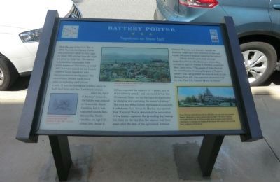
Battery Porter
Napoleons on Stony Hill
After the April 6 Battle of Asheville, the battery was ordered to Greenville, South Carolina, but it was captured outside Hendersonville, North Carolina, on April 23. Union Gen. Alvan C. Gillem reported the capture of “4 pieces and 70 of its infantry guard,” and commended “Lt. Col. (Frederick) Slater for his distinguished gallantry in charging and capturing the enemy’s battery.” The next day, when Gillem negotiated a truce with Confederate Gen. James G. Martin, he reported that “General Martin demanded the restoration of the battery captured the preceding day, basing his claim on the fact that the capture had been made after the date of the agreement between Generals Sherman and Johnson, through the existence might have been unknown to him and myself. Of course I declined restoring the battery.”
Gillem sent the guns back through Asheville to Greenville, Tennessee where they arrived on Apirl 27. Forester A. Sondley, local resident, later wrote, “The people of Asheville had the mortification of seeing the guns of Porter’s battery that had guarded the crest of what is now Battery Park hill, just captured, driven through by (the First U.S. Colored Heavy Artillery).”
(sidebar)Br> Stony Hill was called Battery Porter Hill after the war, but was renamed Battery Park when a hotel opened there in 1886. E.W. Grove reduced the height of the hill by 70 feet in 1824 when he built today’s Battery Park Hotel. To envision the height of the former hill, count to the seventh floor of Battery Park Hotel.
(captions)
(lower left) Combat artist Edwin Forbes sketched this Model 1857 Napoleon in Aug. 1863 - Courtesy Library of Congress
(upper center) Asheville, with Battery Park to right - Courtesy North Carolina Collection, Pack Memorial Library, Asheville
(lower right) Battery Park Hotel - Courtesy North Carolina Collection, Pack Memorial Library, Asheville
Erected by North Carolina Civil War Trails.
Topics and series. This historical marker is listed in this topic list: War, US Civil. In addition, it is included in the North Carolina Civil War Trails series list. A significant historical month for this entry is April 1865.
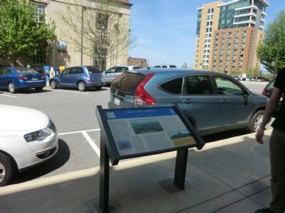
Location. 35° 35.752′ N, 82° 33.424′ W. Marker is in Asheville, North Carolina, in Buncombe County. Marker is at the intersection of O Henry Avenue and Battle Square, on the right when traveling north on O Henry Avenue. Touch for map. Marker is in this post office area: Asheville NC 28801, United States of America. Touch for directions.
Other nearby markers. At least 8 other markers are within walking distance of this marker. Historic Hilltop (within shouting distance of this marker); Shifting Landscapes (about 500 feet away, measured in a direct line); Raphael Guastavino (about 500 feet away); Cat Walk (about 600 feet away); Anne Penland (about 600 feet away); Sweet Harmonies (about 600 feet away); Shopping Daze (about 600 feet away); Flat Iron Architecture (about 700 feet away). Touch for a list and map of all markers in Asheville.
Credits. This page was last revised on June 16, 2016. It was originally submitted on July 20, 2014, by Don Morfe of Baltimore, Maryland. This page has been viewed 798 times since then and 45 times this year. Photos: 1, 2. submitted on July 20, 2014, by Don Morfe of Baltimore, Maryland. • Bernard Fisher was the editor who published this page.

