Sackets Harbor in Jefferson County, New York — The American Northeast (Mid-Atlantic)
Horse Island
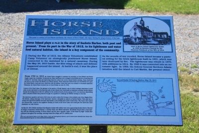
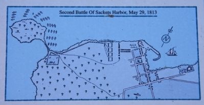
During the War of 1812, the Albany Volunteers established Camp Volunteer on strategically positioned Horse Island, connected to the mainland by a natural causeway. During the May 29, 1813 battle, the first sting of attack and defense happened around the island. At battle's end, it was the place of retreat.
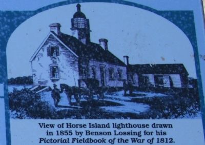
As the sounds of war receded, Horse Island became a pastoral setting for the brick lighthouse built in 1831, which was later destroyed by fire. The lighthouse was rebuilt in 1870, with additions in 1914. By 1926 it was converted into an automatic light. In 1959, the federal General Services Administration sold the island to Carl martin, the present owner.
From 1793 to 1812, the United States struggled to maintain its neutrality as Great Britain and France fought a major war, worldwide, on land and sea. Many Americans were outraged by the british practice of searching and seizing U.S. merchant ships and impressing American sailors into service aboard British warships. Some Americans saw war as a way to drive the british out of North America. These Americans believed that once the british were gone, the United States could deal more effectively with the Indians, whom they saw as an obstacle to westward expansion. Ultimately, the United States declared war on Great Britain on June 18, 1812.
Control of the Great Lakes, the gateway to the interior of North America, was of critical strategic importance to both sides. As the only harbor on the American side of Lake Ontario that could easily accommodate warships, Sackets Harbor became the headquarters of the U.S. military for the northern frontier. By the spring of 1813, the American shipbuilding effort at Sackets Harbor had produced enough of a squadron to challenge the British warships on the lake.
The American squadron and most of the army set sail to attack Fort George at the northern end of the niagara River. The British, taking advantage of the American' absence, attempted an assault on Sackets Harbor. Their goal was to destroy the American facilities and most importantly, a new warship then under construction. This vessel, later named the General Perry, would be the mightiest warship yet built on the Great Lakes and would give the Americans naval dominance on Lake Ontario.
On May 28, 1813, British warships from Kingston loaded with soldiers were seen approaching Sackets Harbor. Diverted by barges of American reinforcements, a contrary wind, and official indecision, the British delayed
their actual landing until the following morning. At Horse Island, and the shore opposite, began 'A Fair Stand Up Fight' [battle] that continued throughout the morning, wavering toward the village and U.S. military hub.
Erected by courtesy of Carl Martin and family, the owners of Horse Island.
Topics. This historical marker is listed in these topic lists: Native Americans • Settlements & Settlers • War of 1812. A significant historical month for this entry is May 1904.
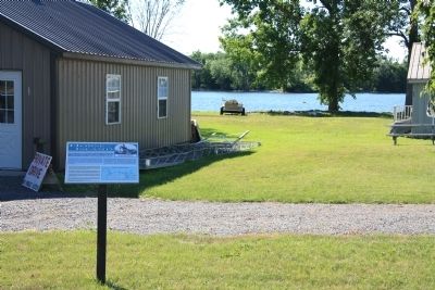
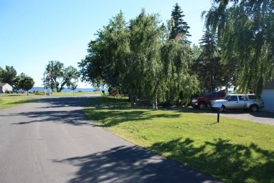
Location. 43° 56.465′ N, 76° 8.281′ W. Marker is in Sackets Harbor, New York, in Jefferson County. Marker is on Ontario Street south of Washington Street, on the right when traveling south. This historial marker is located on residential property, at the point of the mainland that is closest to Horse Island, where the British initiated their attack on Sackets Harbor. Touch for map. Marker is in this post office area: Sackets Harbor NY 13685, United States of America. Touch for directions.
Other nearby markers. At least 8 other markers are within walking distance of this marker. New Brunswick's 104th Regiment of Foot (within shouting distance of this marker); The Landing Area (approx. half a mile away); The British Observation Point (approx. 0.6 miles away); Fort Kentucky (approx. 0.6 miles away); Smoothbore Muzzle Loader Cannon (approx. 0.6 miles away); British Attack on Sackets Harbor
(approx. 0.6 miles away); The British Advance is Halted (approx. 0.6 miles away); American Dragoon Commander Wounded (approx. 0.8 miles away). Touch for a list and map of all markers in Sackets Harbor.
Also see . . . Sackets Harbor Battlefield - National Archives. National Register of Historic Places documentation (Submitted on February 25, 2024, by Anton Schwarzmueller of Wilson, New York.)
Credits. This page was last revised on March 26, 2024. It was originally submitted on July 31, 2014, by Dale K. Benington of Toledo, Ohio. This page has been viewed 503 times since then and 22 times this year. Photos: 1, 2, 3, 4, 5, 6. submitted on July 31, 2014, by Dale K. Benington of Toledo, Ohio.
