Colmar Manor in Prince George's County, Maryland — The American Northeast (Mid-Atlantic)
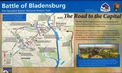
The Road to the Capital
Battle of Bladensburg
— Star-Spangled Banner National Historic Trail —
While the American militia were unable to hold back the British attack at the Anacostia River, Marines and sailors —including U. S. Chesapeake Flotillamen—set up a defense blocking the road outside present-day Fort Lincoln Cemetery. After hours of intense fighting, American forces were overrun and British troops marched to invade the Nation's Capital.
Erected 2014 by The National Park Service.
Topics and series. This historical marker is listed in this topic list: War of 1812. In addition, it is included in the Star Spangled Banner National Historic Trail series list. A significant historical year for this entry is 1812.
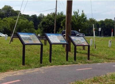
Location. 38° 56.285′ N, 76° 56.587′ W. Marker is in Colmar Manor, Maryland, in Prince George's County. Marker can be reached from Bladensburg Road. Marker is in Colmar Manor Park on the west end of the bridge over which Bladensburg Road (MD 450) crosses the Ancacostia River, along the Anacostia River Trail. Touch for map. Marker is in this post office area: Brentwood MD 20722, United States of America. Touch for directions.
Other nearby markers. At least 8 other markers are within walking distance of this marker. Storming the Bridge (here, next to this marker); Crossroads of Trade and Travel (here, next to this marker); Veterans Memorial (about 700 feet away, measured in a direct line); World War II Honor Roll (about 800 feet away); Peace Cross (about 800 feet away); Undaunted In Battle (approx. 0.2 miles away); a different marker also named The Road to the Capital (approx. 0.2 miles away); Bladensburg Monuments (approx. ¼ mile away). Touch for a list and map of all markers in Colmar Manor.
More about this marker. An identical marker (HMDB 73190) can be found at 40th Avenue and Bladensburg Road and another at Dueling Creek, 38th Avenue and Bladensburg Road.
Photographed By Allen C. Browne, August 2, 2014
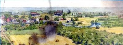
4. Landscape
In the summer of 1814, the landscape of the battlefield was very different than today. Once outside the village of Bladensburg in modern Cottage City and Colmar Manor, buildings gave way to open countryside—gently rolling terrain with farm fields, orchards and forests. Close-up of Richard Schlect's painting on marker
Photographed By Allen C. Browne, August 2, 2014
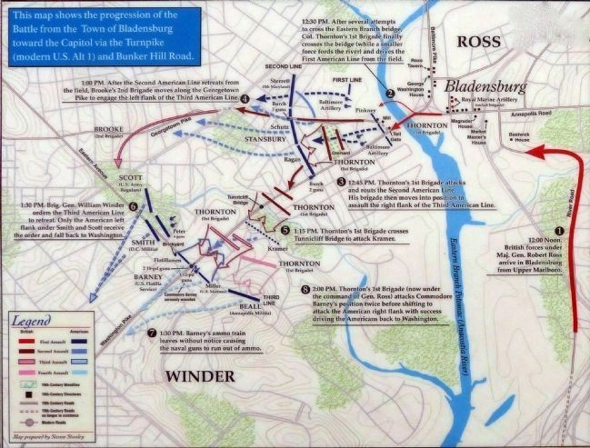
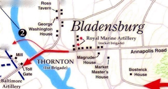
6. 12:30 PM. August 24, 1814
After several attempts to cross the Eastern Branch bridge, Col. Thornton's 1st Brigade finally crosses the bridge (while a smaller force fords the river) and drives the first American Line from the field.Detail of Steven Stanley's Map on Marker
Credits. This page was last revised on June 16, 2016. It was originally submitted on August 4, 2014, by Allen C. Browne of Silver Spring, Maryland. This page has been viewed 516 times since then and 22 times this year. Photos: 1, 2, 3, 4, 5. submitted on August 4, 2014, by Allen C. Browne of Silver Spring, Maryland. 6. submitted on September 13, 2014, by Allen C. Browne of Silver Spring, Maryland. • Bill Pfingsten was the editor who published this page.
