Miami Beach in Miami-Dade County, Florida — The American South (South Atlantic)
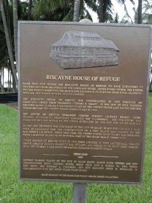
Biscayne House of Refuge
The Biscayne House of Refuge was constructed in 1876 through an executive order from President Ulysses S. Grant. It was one of five stations erected along Florida's southeast coast by the United States Life Saving Service, which became the United States Coast Guard in 1915.
The House of Refuge remained Semper Paratus (always ready) until modern settlement gradually replaced the wilderness. The structure was damaged beyond repair by the Great Hurricane of 1926 and was never rebuilt.
In 1941, the property was conveyed to the City of Miami Beach for use as a public park in exchange for the construction of a new island and station on the MacArthur Causeway. Since that time, the United States Coast Guard has operated from Causeway Island as an integral part of the Miami Beach community.
Other Houses of Refuge built in 1876 were located in Fort Lauderdale, Orange Grove (Delray Beach), Gilbert's Bar (Stuart), and Indian River Inlet (Fort Pierce). Only the Gilbert's Bar House of Refuge remains standing today.
Erected 2005 by City of Miami Beach in collaboration with the United States Coast Guard.
Topics. This historical marker is listed in these topic lists: Disasters • Waterways & Vessels. A significant historical year for this entry is 1876.
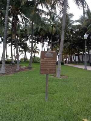
Location. 25° 51.436′ N, 80° 7.227′ W. Marker is in Miami Beach, Florida, in Miami-Dade County. Marker is at the intersection of Collins Avenue (State Road A1A) and 72nd Street, on the right when traveling north on Collins Avenue. Touch for map. Marker is at or near this postal address: 7200 Collins Avenue, Miami Beach FL 33141, United States of America. Touch for directions.
Other nearby markers. At least 8 other markers are within 4 miles of this marker, measured as the crow flies. North Shore Historic District (approx. 0.6 miles away); Ocean Spray Hotel (approx. 3 miles away); Judy Nelson Drucker, Cultural Impresaria (approx. 3 miles away); Westover Arms (approx. 3 miles away); Haulover Beach Sport Fishing Docks (approx. 3.1 miles away); Biscayne (approx. 3.2 miles away); Collins Waterfront Architectural District (approx. 3.3 miles away); Barefoot Mailman (approx. 3.9 miles away). Touch for a list and map of all markers in Miami Beach.
Credits. This page was last revised on June 16, 2016. It was originally submitted on August 4, 2014, by Marsha A. Matson of Palmetto Bay, Florida. This page has been viewed 1,011 times since then and 109 times this year. Photos: 1, 2, 3, 4. submitted on August 4, 2014, by Marsha A. Matson of Palmetto Bay, Florida. • Bernard Fisher was the editor who published this page.


