Fort Montgomery in Orange County, New York — The American Northeast (Mid-Atlantic)
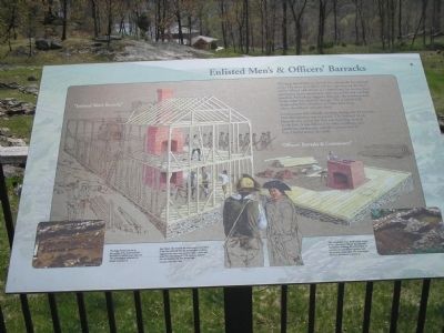
Enlisted Menís & Officersí Barracks
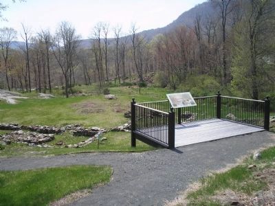
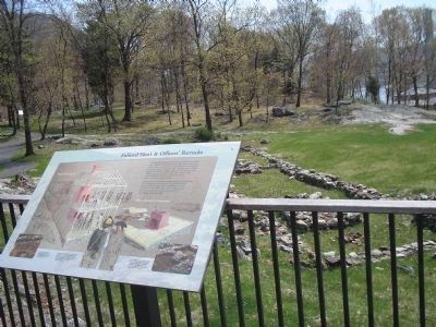
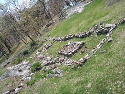
The long foundation to the left was a barracks for enlisted men. The short foundation on the right housed the fortís senior officers and served as a commissary for storing food provisions. Items stored here were controlled and carefully guarded. Archeology suggests that only the northern half of the cellar was used for storage. The southern half of the cellar had a fireplace and may have been where the officersí servants lived.
Construction was virtually constant during the 18 months Fort Montgomery was occupied. The Enlisted Menís Barracks was one of the first two buildings erected in the fort. It was followed by other buildings, gun platforms, earthworks, and the construction of Fort Clinton across the creek.
Erected by Fort Montgomery State Historic Site.
Topics. This historical marker is listed in these topic lists: Forts and Castles • Military • Notable Events • War, US Revolutionary.
Location. 41° 19.516′ N, 73° 59.263′ W. Marker is in Fort Montgomery, New York, in Orange County. Marker is on U.S. 9W, on the right when traveling north. Marker is in Fort Montgomery State Historic Site on the walking trail, near Route 9W. Touch for map. Marker is in this post office area: Fort Montgomery NY 10922, United States of America. Touch for directions.
Other nearby markers. At least 8 other markers are within walking distance of this marker. Soldiersí Necessary (within shouting distance of this marker); Barracks (within shouting distance of this marker); North Redoubt (within shouting distance of this marker); The Battle Around the Redoubts (within shouting distance of this marker); Guard House (within shouting distance of this marker); Fort Montgomery (about 300 feet away, measured in a direct line); Powder Magazine (about 300 feet away); Building a Fort (about 400 feet away). Touch for a list and map of all markers in Fort Montgomery.
More about this marker. The marker is dominated by a picture showing the construction of "Enlisted Menís Barracks" and "Officersí Barracks & Commissary." It has a caption of "Jack Mead, who oversaw the archeological excavation of the fort, believed that the archeological evidence suggested this was a one-story barracks. Letters and maps from the spring of 1776, however, indicate that the barracks was two stories high.
Painting by Dahl Taylor, 2002."
The bottom right and left of the marker are photographs of the excavation of the barracks. The left photo has a caption of "The large mound you see in the middle of the Enlisted Menís Barracks is a nearly intact chimney. The archeologists reburied this feature to protect it." The photo on the right has a caption
of "This remarkably intact brick hearth, found in the cellar of the Officerís Barracks and Commissary building, led archeologists to conclude that the officersí servants used this portion of the cellar. The archeologists reburied this feature to protect it."
Related markers. Click here for a list of markers that are related to this marker. This series of markers follow the walking tour of the Fort Montgomery Battlefield.
Also see . . . The Battle of Fort's (sic) Montgomery and Clinton. The American Revolutionary War website entry (Submitted on May 5, 2008, by Bill Coughlin of Woodland Park, New Jersey.)
Credits. This page was last revised on August 19, 2021. It was originally submitted on May 5, 2008, by Bill Coughlin of Woodland Park, New Jersey. This page has been viewed 1,133 times since then and 19 times this year. Photos: 1, 2, 3, 4, 5. submitted on May 5, 2008, by Bill Coughlin of Woodland Park, New Jersey. • Kevin W. was the editor who published this page.


