Bellefontaine in Logan County, Ohio — The American Midwest (Great Lakes)
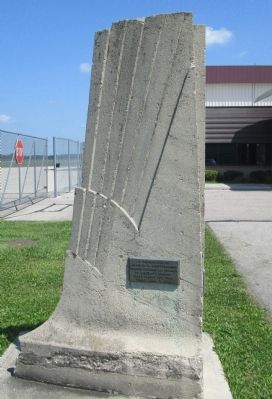
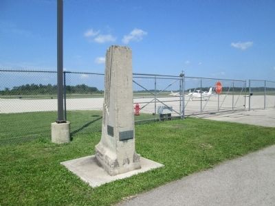
Bellefontaine Airport Pylon
Inscription.
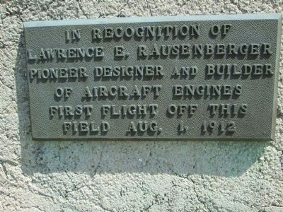
(plaque #1)
In recognition of Lawrence E. Rausenberger pioneer designer and builder of aircraft engines first flight off this field Aug. 1, 1912
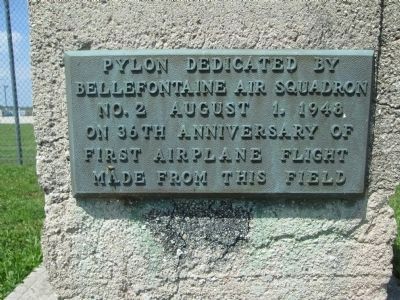
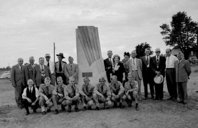
(plaque #2)
Pylon dedicated by Bellefontaine Air Squadron No. 2 August 1, 1948 on 36th anniversary of first airplane flight made from this field
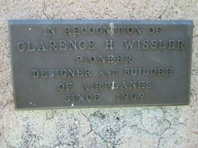
(plaque #3)
in recognition of Clarence H. Wissler pioneer designer and builder of airplanes since 1909
Erected 1948 by Bellefontaine Air Squadron No. 2.
Topics. This historical marker is listed in this topic list: Air & Space. A significant historical date for this entry is August 1, 1778.
Location. 40° 22.206′ N, 83° 49.089′ W. Marker is in Bellefontaine, Ohio, in Logan County. Marker is on Vicario Drive, half a mile north of St Rt 47 West (Ohio Route 47), in the median. marker is located at the edge of the runway, at the end of Vicario Drive, which connects the airport with St Rt 47. Touch for map. Marker is at or near this postal address: 3100 St Rt 47 West, Bellefontaine OH 43311, United States of America. Touch for directions.
Other nearby markers. At least 8 other markers are within 3 miles of this marker, measured as the crow flies. Manary House (approx. 2.1 miles away); Hull's Army in 1812 (approx. 2.1 miles away); Lewis R. Ratleff Park (approx. 2.4 miles away); Harmon Field (approx. 2.4 miles away); Free Servicemen's Canteen, 1942-1946 (approx. 2.9 miles away); Powell Park, the Old Burial Ground (approx. 3 miles away); The Railroad in Logan County (approx. 3 miles away); H.M. Annat Dry Goods & Montgomery Ward Store (approx. 3 miles away). Touch for a list and map of all markers in Bellefontaine.
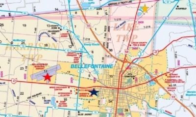
More about this marker. this marker has been moved three times. it originally was set at the old "Tanger Airport". Then moved to the "new" Bellefontaine Municipal Airport in the 1960's. In 2002 it was moved to the new Bellefontaine Regional Airport.
Regarding Bellefontaine Airport Pylon. The marker holds three bronze plaques. It was modeled after the Wright Brother's National Monument at Kitty Hawk, North Carolina.
Additional keywords. first flights, 1909
Photographed By Rev. Ronald Irick, August 26, 2014
11. Bellefontaine Airport Pylon Marker
map showing various locations of this marker. Blue star is the original location, at Tanger's Airport, from 1948 to 1962. Yellow Star marks the "new" Bellefontaine Municipal Airport", now abandoned. Red star indicates current location at Bellefontaine Regional Airport.
Map marked and colored by Dr. Ronald Irick, using Logan County Engineer's current highway map, from Engineer's web- site.
Credits. This page was last revised on August 10, 2021. It was originally submitted on August 26, 2014, by Rev. Ronald Irick of West Liberty, Ohio. This page has been viewed 760 times since then and 23 times this year. Photos: 1, 2, 3, 4, 5, 6, 7, 8, 9, 10, 11. submitted on August 26, 2014, by Rev. Ronald Irick of West Liberty, Ohio. • Al Wolf was the editor who published this page.
