Westmont in Cambria County, Pennsylvania — The American Northeast (Mid-Atlantic)
The Johnstown Flood
Inscription.
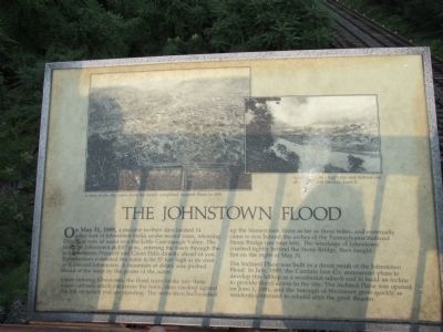
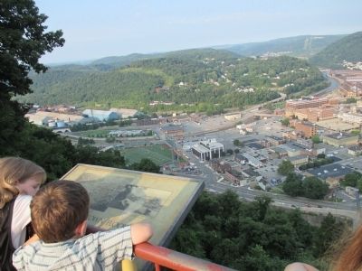
On May 31, 1889, a massive earthen dam located 14 miles east of Johnstown broke under record rains, releasing 20 million tons of water into the little Conemaugh Valley. The flood hit Johnstown at 4:07 p.m., entering the town through the notch between Prospect and Green Hills directly ahead of you. Eyewitnesses estimated the wave to be 37 feet high at its crest as it entered Johnstown. A mountain of debris was pushed ahead of the wave by the power of the water.
Upon entering Johnstown, the flood wave broke into three major currents which cut across the town, then crashed against the hill on which you are standing. The wave then backwashed up Stoneycreek River as far as three miles, and eventually came to rest behind the arches of the Pennsylvania Railroad Stone Bridge (on your left). The wreckage of Johnstown crushed tightly behind the Stone Bridge, then caught fire on the night of May 31.
The Inclined Plane was built as a direct result of the Johnstown Flood. In July 1889, the Cambria Iron Co. announced plans to develop this hilltop as a residential suburb and to build an incline to provide direct access to the city. The Inclined Plane was opened on June 1, 1891, and the borough of Westmont grew quickly as residents continued to rebuild after the great disaster.
A view of the city taken from the newly completed Inclined Plane in 1891.
Accumulated debris caught fire and burned out of control until Sunday, June 2.
Topics. This historical marker is listed in these topic lists: Bridges & Viaducts • Disasters • Waterways & Vessels. A significant historical date for this entry is May 31, 1889.
Location. 40° 19.534′ N, 78° 55.715′ W. Marker is in Westmont, Pennsylvania, in Cambria County. Marker can be reached from Edgehill Drive, 0.2 miles south of Erie Street. Marker is centered and attached to the outermost railing of a steel and concrete public overlook structure adjacent to the summit station of the historic Johnstown Inclined Plane. Touch for map. Marker is at or near this postal address: 711 Edgehill Drive, Johnstown PA 15905, United States of America. Touch for directions.
Other nearby markers. At least 8 other markers are within walking distance of this marker. Johnstown Incline (a few steps from this marker); Calamity and Prosperity (about 700 feet away, measured in a direct line); Westmont Historic District (about 800 feet away); Rolling Mill Mine Disaster (approx. 0.2 miles away); Main Street and Point Stadium Ramp (approx. 0.2 miles away); Johns Street Bridge (approx. 0.4 miles away); Johnstown Local Flood Protection Project (approx. 0.4 miles away); Flood Prevention (approx. 0.4 miles away).
More about this marker. Marker is located in the Borough of Westmont. There is a small free parking lot in Johnstown at the pedestrian bridge to the base of the inclined plane.
Also see . . .
1. The Johnstown Flood - Wikipedia. (Submitted on September 4, 2014, by Anton Schwarzmueller of Wilson, New York.)
2. Johnstown Inclined Plane. (Submitted on September 4, 2014, by Anton Schwarzmueller of Wilson, New York.)

Photographed By Anton Schwarzmueller, August 22, 2014
3. The Overlook Structure and the Inclined Plane Station
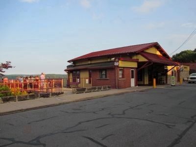
Edgehill Drive. Overlook structure (to the marker) at left. The railings are red with evenly spaced thicker yellow posts. The Johnston Inclined Plane summit station entrance is at the large awning.
Credits. This page was last revised on June 16, 2016. It was originally submitted on September 4, 2014, by Anton Schwarzmueller of Wilson, New York. This page has been viewed 442 times since then and 15 times this year. Photos: 1, 2, 3. submitted on September 4, 2014, by Anton Schwarzmueller of Wilson, New York. • Bill Pfingsten was the editor who published this page.

