Grifton in Pitt County, North Carolina — The American South (South Atlantic)
Burney Place
"... yelling like wild Indians"
— Potter's Raid —
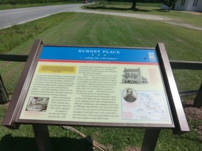
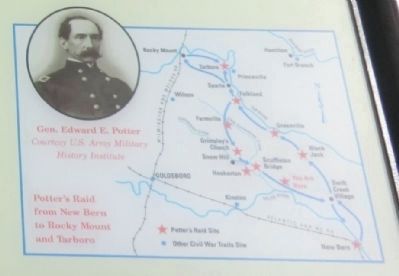
On July 18, 1863, Union Gen. Edward E. Potter led infantry and cavalry from New Bern to destroy the Wilmington and Weldon Railroad bridge at Rocky Mount. The infantry feinted toward Kinston and returned to New Bern. Potter raided Greenville, then sent part of his cavalry to Rocky Mount and occupied Tarboro. The raiders damaged or destroyed bridges, trains, munitions, and mills before returning to New Bern on July 23, but the Confederates restored rail service by Aug. 1.
(main text)
As Union Gen. Edward E. Potter’s column marched through Pitt County toward New Bern, the Confederate 50th North Carolina Infantry attacked its rear nearby on July 22, 1863. They found not only contrabands (escaped slaves) following the Federals, as was usual, but also uniformed black soldiers—most likely members of the 1st North Carolina Colored Volunteers. The black regiment’s enlistment records from the days following Potter’s raid reported new recruits from the North Carolina counties through which the Union forces marched.
On August 5, the New York Times reported that 1,200 contrabands had followed Potter, but half of them were recaptured en route. Lt. J.C. Ellington of the 50th North Carolina Infantry later described the effect of his unit’s attack:
We opened fire on the column with a small brass cannon. … The great cavalcade, composed of men, women and children, perched on wagons, carts, buggies, carriages, and mounted on horses and mules, whipping, slashing, and yelling like wild Indians, was suddenly halted by our fire. … Many others were either killed or wounded in attempting to escape. … We scoured the woods and gathered up several hundred negroes.
The Federals took the Neuse River Road to Piney Neck Road and then marched to Swift Creek, dropping articles they had plundered to delay the Confederates, who stopped to pick them up. Ellington reported that “the roads and woods on either side were strewn with all kinds of wearing apparel (and) table ware, such as fine china and silver ware.” The tactic gave Potter’s men the time they needed to reach Swift Creek.
(captions)
(lower left) Contrabands in New Bern Courtesy MOLLUS, U.S. Army Military History Institute, Carlisle, Pa.
(upper right) Burney Place: Here Maj. John N. Whitford, 1st Battalion North Carolina Local Defense Troops, dispatched patrols to watch the roads from New Bern through Pitt County. Courtesy Roger Kammerer
(lower right) Potter's Raid from New Bern to Rocky Mount and Tarboro; (Inset) Gen. Edward E. Potter Courtesy U.S. Army Military History Institute
Erected by
North Carolina Civil War Trails.
Topics and series. This memorial is listed in these topic lists: African Americans • War, US Civil. In addition, it is included in the North Carolina Civil War Trails series list.
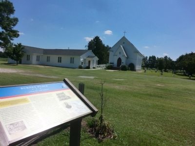
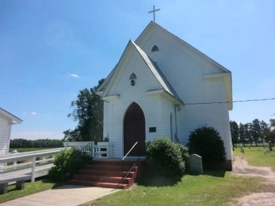
Location. 35° 22.449′ N, 77° 21.552′ W. Marker is in Grifton, North Carolina, in Pitt County. Memorial is at the intersection of Cannon Price Road and Stokestown Saint Johns Road (County Route 1753), on the right when traveling east on Cannon Price Road. The marker is on the grounds of St. Johns Episcopal Church. Touch for map. Marker is at or near this postal address: 2000 Cannon Price Road, Grifton NC 28530, United States of America. Touch for directions.
Other nearby markers. At least 8 other markers are within 8 miles of this marker, measured as the crow flies. Catechna (approx. 4˝ miles away); John Lawson (approx. 4˝ miles away); Blount Hall (approx. 5 miles away); Washington's Southern Tour (approx. 5.8 miles away); Fort Barnwell (approx. 5.8 miles away); a different marker also named Washington's Southern Tour (approx. 7.4 miles away); Former Colleges (approx. 7.4 miles away); Veteran's Memorial (approx. 7.7 miles away). Touch for a list and map of all markers in Grifton.
Credits. This page was last revised on June 16, 2016. It was originally submitted on September 6, 2014, by Don Morfe of Baltimore, Maryland. This page has been viewed 894 times since then and 41 times this year. Photos: 1, 2, 3, 4, 5, 6. submitted on September 6, 2014, by Don Morfe of Baltimore, Maryland. • Bernard Fisher was the editor who published this page.
