Marker Logo HMdb.org THE HISTORICAL
MARKER DATABASE
“Bite-Size Bits of Local, National, and Global History”
Lockport in Niagara County, New York — The American Northeast (Mid-Atlantic)
 

Canal Bridge No. E-225

Day Road


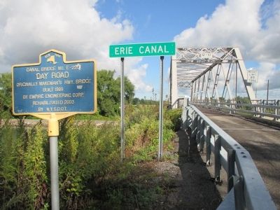
Canal Bridge No. E-225 Marker image. Click for full size.
Photographed By Anton Schwarzmueller, September 16, 2014
1. Canal Bridge No. E-225 Marker
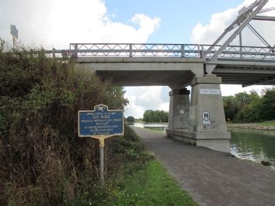
There are three identical markers: south end, north end, and below.
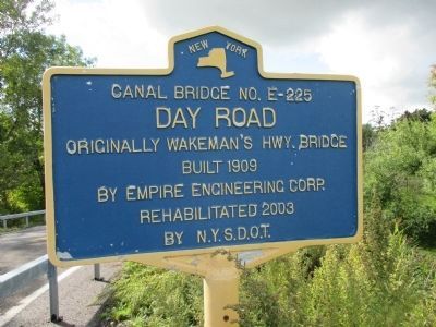
Inscription. Originally Wakeman's Hwy. Bridge. Built 1909 by Empire Engineering Corp. Rehabilitated 2003 by N.Y.S.D.O.T.
 
Topics and series. This historical marker is listed in these topic lists: Bridges & ViaductsWaterways & Vessels. In addition, it is included in the Erie Canal series list. A significant historical year for this entry is 1909.
 
Location. 43° 11.452′ N, 78° 38.995′ W. Marker is in Lockport, New York, in Niagara County. Marker is at the intersection of Day Road and Groff Road, on the left when traveling north on Day Road. There are three identical markers. Two are at either end of the bridge and one is on the Erie Canal towpath below. There is free public parking at the north end of the bridge off North Canal Road. The tow path is on the north side of the canal. Touch for map. Marker is in this post office area: Lockport NY 14094, United States of America. Touch for directions.
 
Other nearby markers. At least 8 other markers are within 2 miles of this marker, measured as the crow flies. Cold Springs Cemetery (approx. 0.6 miles away); Chestnut Ridge (approx. 0.8 miles away); Canal Bridge No. E-224 (approx. 0.9 miles away); Lockport (approx. 0.9 miles away); Gertrude Warren (approx. 1.2 miles away); The Niagara Grape (approx. 1.3 miles away); Wyndham Lawn (approx. 1.3 miles away); City of Lockport Medal of Honor Recipients (approx. 1.4 miles away). Touch for a list and map of all markers in Lockport.
Paid Advertisement
Click on the ad for more information.
Please report objectionable advertising to the Editor.
Click or scan to see
this page online

 
More about this marker. Bridge is single lane bidirectional traffic without signals.
 
Also see . . .  Day Road Bridge - Historic Bridges.org. (Submitted on September 29, 2014, by Anton Schwarzmueller of Wilson, New York.)
 
Canal Bridge No. E-225 Marker image. Click for full size.
Photographed By Anton Schwarzmueller, September 16, 2014
2. Canal Bridge No. E-225 Marker
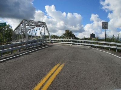
Northbound on Day Road at Groff Road. Marker at left.
Canal Bridge No. E-225 Marker image. Click for full size.
Photographed By Anton Schwarzmueller, September 16, 2014
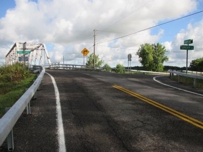
3. Canal Bridge No. E-225 Marker
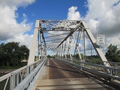
Northbound view.
Canal Bridge No. E-225 Northbound image. Click for full size.
Photographed By Anton Schwarzmueller, September 16, 2014
4. Canal Bridge No. E-225 Northbound
Note the towpath on the far (north) side of the canal, seen at left.
Canal Bridge No. E-225 Marker image. Click for full size.
Photographed By Anton Schwarzmueller, September 16, 2014
5. Canal Bridge No. E-225 Marker
Southbound, an identical marker is on the right.
Canal Bridge No. E-225 Marker image. Click for full size.
Photographed By Anton Schwarzmueller, September 16, 2014
6. Canal Bridge No. E-225 Marker
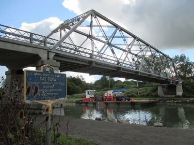
Here is the marker on the towpath and the marker on the north end of the bridge.
Canal Bridge No. E-225 image. Click for full size.
Photographed By Anton Schwarzmueller, September 16, 2014
7. Canal Bridge No. E-225
A mobile boom on a barge under the bridge. One man is on the boom performing bridge maintanence and the other man is boots on the barge.
Canal Bridge No. E-225 image. Click for full size.
Photographed By Anton Schwarzmueller, September 16, 2014
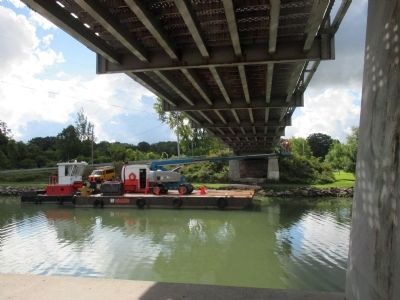
8. Canal Bridge No. E-225
Under the bridge on the tow path, north side of the Erie Canal.
Canal Bridge No. E-225 image. Click for full size.
Photographed By Anton Schwarzmueller, September 16, 2014
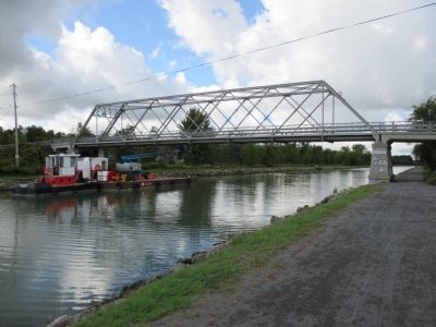
9. Canal Bridge No. E-225
View westward in the direction of the City of Lockport. The bridge is in the Town of Lockport.
 
 
Credits. This page was last revised on June 16, 2016. It was originally submitted on September 29, 2014, by Anton Schwarzmueller of Wilson, New York. This page has been viewed 383 times since then and 11 times this year. Photos:   1, 2, 3, 4, 5, 6, 7, 8, 9. submitted on September 29, 2014, by Anton Schwarzmueller of Wilson, New York. • Bill Pfingsten was the editor who published this page.
Share this page.  
Share on Tumblr
m=77553

CeraNet Cloud Computing sponsors the Historical Marker Database.
This website earns income from purchases you make after using our links to Amazon.com. We appreciate your support.
Paid Advertisements
Mar. 18, 2024