Quincy Township near Fayetteville in Franklin County, Pennsylvania — The American Northeast (Mid-Atlantic)
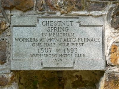
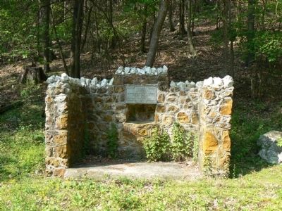
Chestnut Spring
Workers at Mont Alto Furnace
One Half Mile West
1807 1893
Erected 1929 by Waynesboro Motor Club.
Topics. This historical marker is listed in these topic lists: Landmarks • Natural Features. A significant historical year for this entry is 1893.
Location. 39° 50.275′ N, 77° 31.957′ W. Marker is near Fayetteville, Pennsylvania, in Franklin County. It is in Quincy Township. Marker is on Mont Alto Road (Pennsylvania Route 233), on the left when traveling west. The marker is near the entrance to Mont Alto State Park. Touch for map. Marker is in this post office area: Fayetteville PA 17222, United States of America. Touch for directions.
Other nearby markers. At least 8 other markers are within 4 miles of this marker, measured as the crow flies. Conklin Hall (approx. half a mile away); George H. Wirt (approx. half a mile away); Mont Alto (approx. 0.6 miles away); Ralph Elwood Brock (approx. 0.6 miles away); Pennsylvania State Forest Academy (approx. 0.6 miles away); Captain John E. Cook (approx. 0.6 miles away); John Brown Raid (approx. 0.6 miles away); Snow Hill Cloister (approx. 4 miles away).
More about this marker. The spring is now dry.
Credits. This page was last revised on February 7, 2023. It was originally submitted on May 18, 2008, by Peter Linehan of Shippensburg, Pennsylvania. This page has been viewed 1,323 times since then and 34 times this year. Photos: 1, 2. submitted on May 18, 2008, by Peter Linehan of Shippensburg, Pennsylvania. • Kevin W. was the editor who published this page.

