Near Cheyenne Wells in Cheyenne County, Colorado — The American Mountains (Southwest)
Trails West
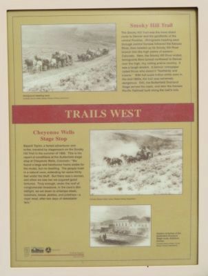
The Smoky Hill Trail was the most direct route to Denver and the goldfields of the central Rockies. Immigrants heading west through central Kansas followed the Kansas River, then headed up its Smoky Hill River branch into the high plains of eastern Colorado. Here, the Smoky Hill River ended. Immigrants then turned northwest to Denver over the high, dry rolling prairie country. It was a tough stretch. A Denver newspaper called those who dared it "foolhardy and insane." With full-scale Indian-white wars of the mid-1860s, the trail was extremely dangerous. Still, the Butterfield Overland Stage served the route, and later the Kansas Pacific Railroad built along the trail's ruts.
Cheyenne Wells Stage Stop
Bayard Taylor, a famed adventurer and writer, traveled by stagecoach on the Smoky Hill Trail in the summer of 1866. This is his report of conditions at the Butterfield stage stop at Cheyenne Wells, Colorado: "We found a large and handsome frame stable for the mules, but no dwelling. The people lived in a natural cave, extending for some thirty feet under the bluff. But there was a woman, and when we saw her we augured good fortunes. Truly enough, under the roof of conglomerate limestone, in the cave's dim twilight, we sat down to antelope steak, tomatoes, bread, pickles, and potatoes--a royal meal, after two days of detestable fare."
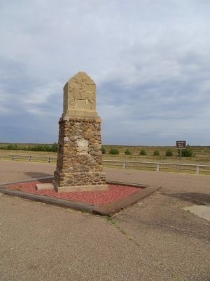
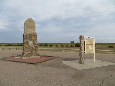
Erected 1997 by Colorado Historical Society. (Marker Number 207.)
Topics and series. This historical marker is listed in this topic list: Roads & Vehicles. In addition, it is included in the Colorado - History Colorado series list. A significant historical year for this entry is 1866.
Location. 38° 48.757′ N, 102° 28.133′ W. Marker is near Cheyenne Wells, Colorado, in Cheyenne County. Marker is on U.S. 40 at milepost 463.5, on the left when traveling east. Touch for map. Marker is in this post office area: Cheyenne Wells CO 80810, United States of America. Touch for directions.
Other nearby markers. At least 1 other marker is within 7 miles of this marker, measured as the crow flies. Cheyenne County Jail (approx. 6.4 miles away).
Also see . . . Smoky Hills Trail History. Kansas Historical Trails' page for the Smoky Hills Trail. On the Butterfield Overland Dispatch: Col. David A. Butterfield established a stage line, the Butterfield Overland Dispatch, to carry freight and passengers from Atchison, Kansas to Denver, Colorado. It traveled the 592 mile long Smoky Hill Route during the line's existence (June 1865 - August 18, 1870). Relay stations were built every twelve miles for the passenger's comfort. The stage line was sold in 1866 to Ben Holladay.
Ben Holladay sold out in 1866 to Wells, Fargo and Company. The stage line grew shorter as the Kansas Pacific Railroad moved toward Denver, and in 1870 the stage line was no longer needed. The coming of the railroad marked the end of the stagecoach era in American history. (Submitted on October 12, 2014.)
Credits. This page was last revised on June 16, 2016. It was originally submitted on October 12, 2014, by Bill Kirchner of Tucson, Arizona. This page has been viewed 1,049 times since then and 50 times this year. Photos: 1, 2, 3, 4. submitted on October 12, 2014, by Bill Kirchner of Tucson, Arizona. • Andrew Ruppenstein was the editor who published this page.


