Little Falls in Morrison County, Minnesota — The American Midwest (Upper Plains)
Little Falls and the Mississippi River
Inscription.
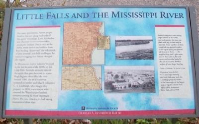
For many generations, Native people lived in this area along the banks of the upper Mississippi. Later, fur traders and Christian missionaries worked among the Indians. But as early as the 1830s, white settlers and soldiers from Fort Snelling "discovered" the rich stands of pines around Little Falls and began the extensive logging that forever changed the region.
As Minnesota's timber industry boomed in the last decades of the 1800s, so did Little Falls. Sawmills sprouted around the rapids that gave the town its name. Huge logjams often filled the river. Around 1900, the local economy centered on lumber and related industries. C. A. Lindbergh, who bought this property in 1898, was a lawyer who counted the Weyerhaeuser lumber company among his most important clients. His son, Charles, Jr., had strong memories of those days.
Lumber companies were cutting virgin timber in the north, and each summer the river was filled with logs on their way to sawmills. Great numbers of them would pile up against boulders in the rapids until jams formed all the way to shore.... The neighbor boys and I often went out on these jams to fish and swim, and stretched naked in the sun on the warm, barkless surface of some larger butt log.
Charles A. Lindbergh, The Spirit of St. Louis
[Photo captions] Clockwise from far left:
1923 plat maps showing the Little Falls area, with the Lindbergh property shown at the lower right of the largest map;
a logjam at Little Falls, about 1890;
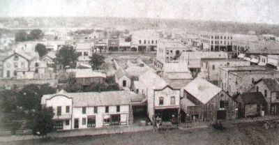
downtown Little Falls, about 1890
Erected by Minnesota Historical Society.
Topics and series. This historical marker is listed in these topic lists: Horticulture & Forestry • Industry & Commerce • Settlements & Settlers • Waterways & Vessels. In addition, it is included in the Minnesota Historical Society series list. A significant historical year for this entry is 1900.
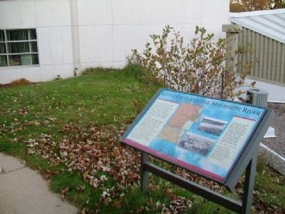
Location. 45° 57.584′ N, 94° 23.223′ W. Marker is in Little Falls, Minnesota, in Morrison County. Marker is on Lindbergh Drive South, on the left when traveling south. Marker is adjacent to the Charles A. Lindbergh Historic Site Visitor Center. Touch for map. Marker is at or near this postal address: 1620 Lindbergh Drive South, Little Falls MN 56345, United States of America. Touch for directions.
Other nearby markers. At least 8 other markers are within walking distance of this marker. A Boyhood on the Mississippi (within shouting distance of this marker); Lindbergh State Park (about 300 feet away, measured in a direct line); Lindbergh House (about 400 feet away); Tenant Farmer House (about 700 feet away); WPA Water Tower & Shelter Building (approx. 0.2 miles
away); Childhood Memories of a Magical Place (approx. 0.2 miles away); The Boyhood Farm of Charles Lindbergh (approx. 0.2 miles away); The WPA Builds a Park in the Rustic Style (approx. 0.2 miles away). Touch for a list and map of all markers in Little Falls.
Also see . . .
1. History of Little Falls MN. City website entry (Submitted on October 22, 2014, by William Fischer, Jr. of Scranton, Pennsylvania.)
2. Charles A. Lindbergh House and Museum. Minnesota Historical Society website entry (Submitted on October 22, 2014, by William Fischer, Jr. of Scranton, Pennsylvania.)
Credits. This page was last revised on November 11, 2023. It was originally submitted on October 22, 2014, by William Fischer, Jr. of Scranton, Pennsylvania. This page has been viewed 478 times since then and 30 times this year. Photos: 1, 2, 3, 4. submitted on October 22, 2014, by William Fischer, Jr. of Scranton, Pennsylvania.


