Near Blair in Washington County, Nebraska — The American Midwest (Upper Plains)
DeSoto Townsite
Inscription.
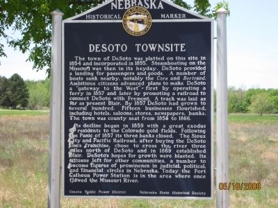
The town of DeSoto was platted on this site in 1854 and incorporated in 1855. Steamboating on the Missouri was then in its heyday. DeSoto provided a landing for passengers and goods. A number of boats sank nearby, notably the Cora and Bertrand. Ambitious citizens advanced plans to make DeSoto a "gateway to the West" - first by operating a ferry in 1857 and later by promoting a railroad to connect DeSoto with Fremont. A track was laid as far as present Blair. By 1857 DeSoto had grown to several hundred. Fifteen businesses flourished, including hotels, saloons, stores, newspapers, banks. The town was county seat from 1858 to 1866.
Its decline began in 1859 with a great exodus of residents to the Colorado gold fields. Following the Panic of 1857 its three banks closed. The Sioux City and Pacific Railroad, after buying the DeSoto line's franchise, chose to cross the river three miles north of DeSoto and in 1869 established Blair. DeSoto's hopes for growth were blasted. Its citizens left for other communities, a number to become figures of prominence in judicial, political, and financial circles in Nebraska. Today the Fort Calhoun Power Station is in the area where once flowed the Missouri River.
Erected by Omaha Public Power District, Nebraska State Historical Society. (Marker Number 119.)
Topics and series. This historical marker is listed in these topic lists: Notable Places • Settlements & Settlers • Waterways & Vessels. In addition, it is included in the Nebraska State Historical Society series list. A significant historical year for this entry is 1854.
Location. 41° 30.759′ N, 96° 4.789′ W. Marker is near Blair, Nebraska, in Washington County. Marker is at the intersection of U.S. 75 and Power Line Road (County Route 41), on the right when traveling north on U.S. 75. Touch for map. Marker is in this post office area: Blair NE 68008, United States of America. Touch for directions.
Other nearby markers. At least 8 other markers are within 5 miles of this marker, measured as the crow flies. Up the Missouri (approx. 2.2 miles away); The Lewis and Clark Expedition (approx. 2.2 miles away); Steamboat Bertrand (approx. 2.7 miles away); Lewis and Clark Campsites (approx. 3.1 miles away); Congregational Church of Blair (approx. 3˝ miles away); Lewis and Clark Campsite Area (approx. 4.1 miles away); Fort Atkinson (approx. 4.8 miles away); The Death of Marshal Suverkrubbe (approx. 5.1 miles away). Touch for a list and map of all markers in Blair.
More about this marker. The marker is located just off the highway (U.S. 75)on the entrance road to the Fort Calhoun Nuclear Power Plant. It can be seen from U.S. 75.
Credits. This page was last revised on June 16, 2016. It was originally submitted on May 20, 2008, by Michael James of Fort Calhoun, Nebraska. This page has been viewed 1,524 times since then and 19 times this year. Photo 1. submitted on May 20, 2008, by Michael James of Fort Calhoun, Nebraska. • Kevin W. was the editor who published this page.
