Towson in Baltimore County, Maryland — The American Northeast (Mid-Atlantic)
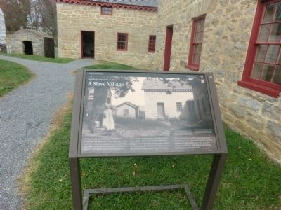
A Slave Village
Hampton National Historic Site
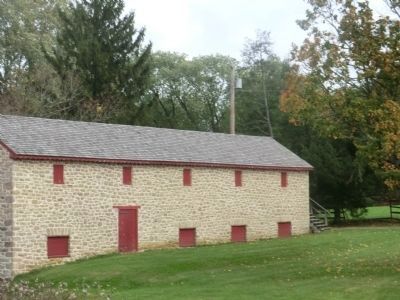
To our eyes, the stone facades and decorative woodwork that adorn these buildings seem at odds with their use as slave quarters. But the entire farm site—based on a popular European architectural concept called ferme ornee (ornamental farm)--was intentionally designed to look like a picturesque village. Such ornamentation offered the Ridgelys a more pleasing view from the mansion. The living quarters were located in the center of the farm, in close proximity to places of work. Enslaved families were often large and the space was likely crowded. Most slaves had few personal possessions, and children likely slept on a straw mattress on the floor. After Emancipation those buildings housed tenant farmers.
(Inscription in the lower right)
This photograph shows the quarters as they looked in 1897 when tenant farmers resided here. Ashes, used for making soap, were collected in the small stone house to the left. Some of the tenant farmers had been or were descended from slaves on the estate.
Erected by National Park Service-United States Department of the Interior.
Topics. This historical marker is listed in these topic lists: African Americans • Colonial Era • Patriots & Patriotism. A significant historical year for this entry is 1855.
Location.
Other nearby markers. At least 8 other markers are within walking distance of this marker. Quarters #2 & 3 (within shouting distance of this marker); The Lower House (within shouting distance of this marker); The View from Below (within shouting distance of this marker); The Cream of Hampton (within shouting distance of this marker); Hampton: An American Story (within shouting distance of this marker); Corn Culture (about 300 feet away, measured in a direct line); Thoroughbreds at Hampton (approx. 0.2 miles away); a different marker also named Hampton: An American Story (approx. 0.3 miles away). Touch for a list and map of all markers in Towson.
Credits. This page was last revised on June 16, 2016. It was originally submitted on November 6, 2014, by Don Morfe of Baltimore, Maryland. This page has been viewed 751 times since then and 31 times this year. Photos: 1, 2, 3. submitted on November 6, 2014, by Don Morfe of Baltimore, Maryland. • Bill Pfingsten was the editor who published this page.


