Near Church Creek in Dorchester County, Maryland — The American Northeast (Mid-Atlantic)
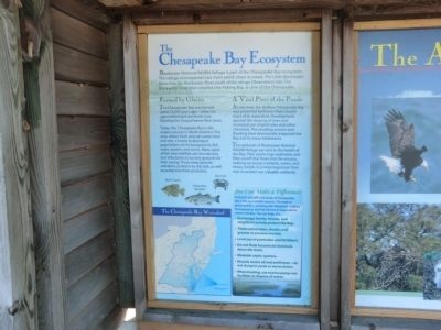
The Chesapeake Bay Ecosystem
Blackwater National Wildlife Refuge
Blackwater National Wildlife Refuge is part of the Chesapeake Bay ecosystem. This refuge encompasses two rivers which share its name. The Little Blackwater flows into the Blackwater River south of the refuge Observation Site. The Blackwater River then empties into Fishing Bay, and arm of the Chesapeake.
Formed by Glacier
The Chesapeake Bay was formed some 15,000 years ago---when ice caps melted and sea levels rose, flooding the Susquehanna River basin.
Today, the Chesapeake Bay is the largest estuary in North America. This area, where fresh and salt water meet and mix, is home to abundant populations of microorganisms, fish, crabs, oysters and clams. Many types of fish and shellfish use the marshes and tributaries as nursery grounds for their young. These areas provide nutrients carried in by the tide, as well as protection from predators.
A Vital Piece of the Puzzle
At one time, the shallow Chesapeake Bay was protected by forests that covered most of its watershed. Development spurred the clearing of trees and increased use of pesticides and other chemicals. The result erosion and flooding have dramatically impacted the Bay and its many inhabitants.
The wetlands of Blackwater National Wildlife Refuge are vital to the health of the Bay. Their plants trap settlements and filter runoff that flows into the estuary, soaking up excess nutrients, toxins, and heavy metals. It is more important than ever to protect our valuable wetlands.
Topics. This historical marker is listed in these topic lists: Animals • Environment.
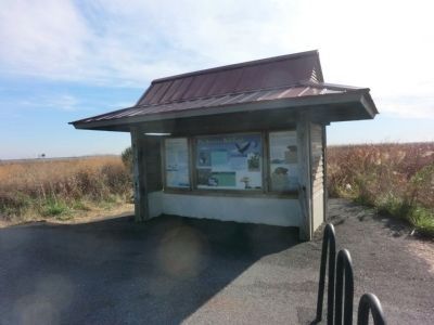
Location. 38° 26.25′ N, 76° 5.55′ W. Marker is near Church Creek, Maryland, in Dorchester County. Marker is on Observation Acess Road. The marker is in a kiosk with two other markers. Touch for map. Marker is in this post office area: Cambridge MD 21613, United States of America. Touch for directions.
Other nearby markers. At least 8 other markers are within 2 miles of this marker, measured as the crow flies. The American Bald Eagle (here, next to this marker); Muskrat and Nutria (here, next to this marker); Pool One at Wildlife Drive (approx. 0.4 miles away); Delmarva Peninsula Fox Squirrel (approx. 0.9 miles away); Why Use Native Plants? (approx. 1.6 miles away); Welcome to Blackwater National Wildlife Refuge (approx. 1.6 miles away); a different marker also named Welcome to Blackwater National Wildlife Refuge (approx. 1.6 miles away); Blackwater National Wildlife Refuge (approx. 1.6 miles away). Touch for a list and map of all markers in Church Creek.
Credits. This page was last revised on August 28, 2022. It was originally submitted on November 24, 2014, by Don Morfe of Baltimore, Maryland. This page has been viewed 308 times since then and 9 times this year. Photos: 1, 2. submitted on November 24, 2014, by Don Morfe of Baltimore, Maryland. • Bill Pfingsten was the editor who published this page.

