Massena in St. Lawrence County, New York — The American Northeast (Mid-Atlantic)
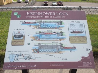
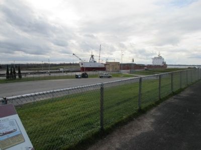
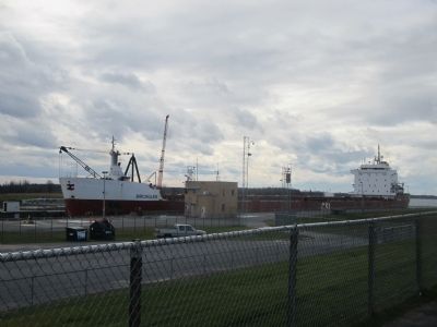
Eisenhower Lock
Stepping Down the St. Lawrence
— History of the Coast —
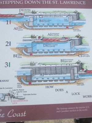
How Does a Lock Work?
1) A) Filling valve opened. Emptying valve closed.
B) Water enters by gravity. Gate closed. Ship waiting to enter.
C) Chamber fills to upstream level.
D) Attendant opens gate. Catch cable lowered.
2) A) Attendants tie off ship.
B) Filling valve closed.
C) Emptying valve opens.
D) Water empties by gravity.
3) A) Water equals down stream level.
B) Downstream gates open. Filling valve closed. Emptying valve open.
C) Ship departs.
A Tight Fit. Lock Cross Section.
Navigators must thread their massive ships into a space that is only slightly larger than the ship's beam (width.)
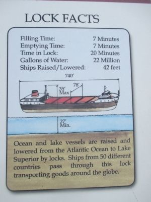
Lock Facts
Filling Time: 7 Minutes
Emptying Time: 7 Minutes
Time in Lock: 20 Minutes
Gallons of Water: 22 Million
Ships Raised/Lowered: 42 feet
Ocean and lake vessels are raised and lowered from the Atlantic Ocean to Lake Superior by locks. Ships from 50 different countries pass through this lock transporting goods around the globe.
Profile of the St. Lawrence Seaway
Lake Superior, Lake Michigan, Lake Huron, Lake Erie, Lake Ontario, Lake St. Lawrence, The Eisenhower Lock, Lake St. Francis, Lake St. Louis, Tidewater Section
The Seaway connects the interior U.S. and Canadian markets to the world
Seaway Trail, Inc., Corner Ray & West Main St., Sackets Harbor, NY 13685, 1-800-SEAWAY-T. This exhibit made possible by a grant from FHWA to Seaway Trail, Inc.
Erected by Seaway Trail, Inc.
Topics and series. This historical marker is listed in this topic list: Waterways & Vessels. In addition, it is included in the Great Lakes Seaway Trail National Scenic Byway series list.
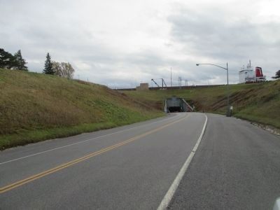
Location. 44° 58.814′ N, 74° 51.017′ W. Marker is in Massena, New York, in St. Lawrence County. Marker can be reached from Barnhart Island Road, 1.1 miles north of New York State Route 131. Marker is at the overlook on the north side of the lock. From NY Route 131, travel north on Barnhart Island Road towards Robert Moses State Park. After exiting the tunnel under the lock, make a right hairpin turn to the overlook area. As the road enters the parking area, the marker is straight ahead, across the parking lot. Touch for map. Marker is in this post office area: Massena NY 13662, United States of America. Touch for directions.
Other nearby markers. At least 8 other markers are within 6 kilometers of this marker, measured as the crow flies. One Lane Bridge (approx. 1.7 miles away); St. Lawrence - Franklin D. Roosevelt Power Project (approx. 2.7 miles away); Moulinette (approx. 3.6 miles away in Canada); Lost Villages of the St Lawrence (approx. 5.8 kilometers away in Canada); Manson / LaPierre General Store (approx. 5.8 kilometers away in Canada); Zina Hill Barber Shop / Le Salon de Barbier de Zina Hill (approx. 5.8 kilometers away in Canada); Moulinette Station (approx. 5.8 kilometers away in Canada); Corn Crib (approx. 5.8 kilometers away in Canada). Touch for a list and map of all markers in Massena.
Also see . . . Saint Lawrence Seaway - Wikipedia. (Submitted on December 1, 2014, by Anton Schwarzmueller of Wilson, New York.)
Credits. This page was last revised on July 29, 2020. It was originally submitted on December 1, 2014, by Anton Schwarzmueller of Wilson, New York. This page has been viewed 675 times since then and 38 times this year. Photos: 1, 2, 3, 4, 5, 6, 7, 8. submitted on December 1, 2014, by Anton Schwarzmueller of Wilson, New York. • Bill Pfingsten was the editor who published this page.
