Ferryland in Avalon Peninsula, Newfoundland, Newfoundland and Labrador — The Atlantic Provinces (North America)
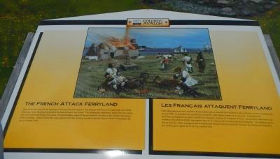
The French Attack Ferryland
Les Français attaquent Ferryland
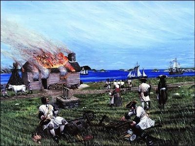
This illustration depicts the burning of a house that once stood at this location and was excavated in the mid-1990s. The large stone fireplace foundation has been left as it was found. The rectangular depression marks the area where the wood frame dwelling once stood. Charred timbers, ash and burned artifacts all attest to the violent destruction of the dwelling. Artifacts from ruins indicate that the burning resulted from the French attack of Ferryland by sea in October 1696.
French:
Cette illustration montre l’incendie d’une maison qui se trouvait à cet endroit et qui mise au jour au milieu années 1990. Le fondation du grand foyer de pierre a été laissée comme on l’a trouvée. La dépression de forme rectangulaire marque l’endroit où se dressait autrefois la charpente de bois. Les poutres carbonisées, les cendres et les artefacts brûlés témoignent tous de la violence de la destruction de l’habitation. Les artefacts qu’on trouve dans les ruines indiquent que la destruction est survenue à la suite de ‘attaque de Ferryland déclenchée par les Français à partir de la mer, en octobre 1696.
Topics. This historical marker is listed in this topic list: War, French and Indian. A significant historical month for this entry is October 1696.
Location. 47° 1.37′ N, 52° 52.683′ W. Marker is in Ferryland, Newfoundland and Labrador, in Avalon Peninsula, Newfoundland. Marker can be reached from Newfoundland and Labrador Route 10, on the right when traveling north. Touch for map. Marker is in this post office area: Ferryland NL A0A, Canada. Touch for directions.
Other nearby markers. At least 2 other markers are within walking distance of this marker. Colony of Avalon (approx. half a kilometer away); Ferryland (approx. 0.6 kilometers away).
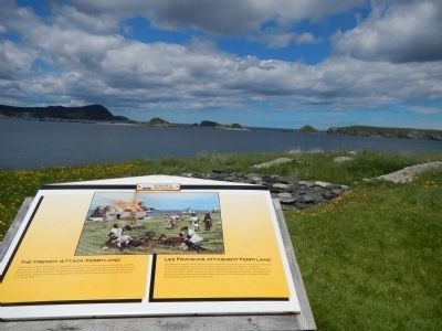
More about this marker. This marker is located at the Colony of Avalon archaeology site.
Also see . . . Avalon Peninsula Campaign - Wikipedia. The Avalon Peninsula Campaign occurred during King Williams War when forces of New France, led by Pierre Le Moyne d'Iberville and Governor Jacques-François de Monbeton de Brouillan, destroyed 23 English settlements along the coast of the Avalon Peninsula, Newfoundland in the span of three months. (Submitted on December 8, 2014, by Barry Swackhamer of Brentwood, California.)
Additional keywords. King William's War
Credits. This page was last revised on June 16, 2016. It was originally submitted on December 8, 2014, by Barry Swackhamer of Brentwood, California. This page has been viewed 379 times since then and 14 times this year. Photos: 1, 2, 3. submitted on December 8, 2014, by Barry Swackhamer of Brentwood, California. • Andrew Ruppenstein was the editor who published this page.


