Ashland near Cherry Hill in Camden County, New Jersey — The American Northeast (Mid-Atlantic)
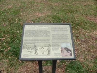
The Outbuildings at Croft Farm
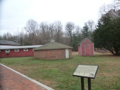
Icehouse (left) Much like its name suggests, an icehouse was designed to store ice for months at a time. Blocks of ice cut from the adjacent pond in winter were stacked on the dirt floor, which lies three feet below ground level. Straw and sawdust were packed around the ice to prevent melting. The large overhanging roof and openings just below the roofline provided shade and ventilation. Stored properly, ice could last through the following fall or winter.
Smokehouse (center) The smokehouse at Croft Farm was used to cure and smoke meat prior to the winter months. The meat was salted to draw out the moisture and then smoked to seal it from rotting. The meat hung on iron hooks as far from the fire pit as possible, since it was the smoke, not the heat, that accomplished the curing. For that reason, a smokehouse was typically built without a chimney or windows. Smoked meat could be stored for months without risk of spoiling.
Springhouse (right) The springhouse served as the “refrigerator” for the Evans Family at Croft Farm. Generally, the best-designed farms included a springhouse, a small building used for the storage of food that would otherwise spoil, such as dairy products, eggs, or meat. By locating the structure over a localized spring, the constant flow of water provided a cool temperature inside the structure year round. Food supplies were stored in jugs and crocks and placed directly in the water on the floor of the springhouse, as illustrated below, or hung from hooks above.
In the mid-Atlantic region, the springhouse was typically a two-story structure; the upper room was often used as a workspace or for additional storage of canned and preserved foods. Stone and mortar construction was typical for a springhouse, as stone retained cool temperatures better than wood.
(Inscription under the drawing in the left bottom)
Workers cut ice from a frozen pond. Ice-cutting was a major American industry in the 19th and early 20th centuries.
(Inscription under the photo in the lower right)
Typical interior of a 19th century mid-Atlantic springhouse shown at right. Courtesy of the Daniel Boone Homestead
Topics. This historical marker is listed in these topic lists: Agriculture • Settlements & Settlers.
Location. 39° 54′ N, 75° 1.2′ W. Marker is near Cherry Hill, New Jersey, in Camden County. It is in Ashland. Marker is on Bortons Mill Road. This marker is located on the Kay-Evans House at Croft Farm property. Touch for map. Marker is at or near this postal address: 100 Bortons Mill Rd, Cherry Hill NJ 08034, United States of America. Touch for directions.
Other nearby markers. At least 8 other markers are within walking distance of this marker. The Kay-Evans House at Croft Farm (within shouting distance of this marker); Free Wheel (within shouting distance of this marker); Alfred Eastlack Driscoll (approx. 0.3 miles away); Hessian Army during the Revolutionary War (approx. 0.3 miles away); Roll of Honor (approx. 0.3 miles away); Memorial High School (approx. 0.3 miles away); Haddonfield Veterans Memorial (approx. 0.3 miles away); Haddonfield World War I Honor Roll (approx. 0.4 miles away). Touch for a list and map of all markers in Cherry Hill.
Credits. This page was last revised on April 24, 2023. It was originally submitted on December 11, 2014, by Don Morfe of Baltimore, Maryland. This page has been viewed 385 times since then and 13 times this year. Photos: 1, 2. submitted on December 11, 2014, by Don Morfe of Baltimore, Maryland. • Bill Pfingsten was the editor who published this page.

