Saddler’s Woods
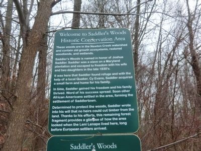
Saddler’s Woods is named in honor of Joshua Saddler. Saddler was a slave on a Maryland plantation and escaped to freedom with his wife and two daughters in the late 1830’s. It was here that Saddler found refuge and with the help of a local Quaker, Cy Evans, Saddler acquired a small farm and home for his family.
In time, Saddler gained his freedom and his family thrived. Word of his success spread. Soon other African Americans settled in the area, forming the settlement of Saddlertown.
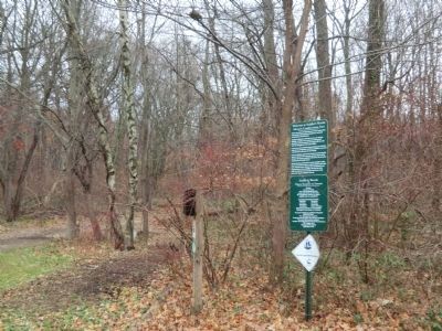
Determined to protect the woods, Saddler wrote into his will that no heirs could cut timber from the land. Thanks to his efforts, this remaining forest fragment provides a glimpse of how the area looked when the Leni Lenape lived here, long before European settlers arrived.
Topics and series. This historical marker is listed in these topic lists: Abolition & Underground RR • African Americans. In addition, it is included in the Quakerism series list.
Location. 39° 54.066′ N, 75° 3.534′ W. Marker is in Haddon Township, New Jersey, in Camden County. It is in Westmont. Marker is
Other nearby markers. At least 8 other markers are within 2 miles of this marker, measured as the crow flies. Saddlertown (approx. ¼ mile away); Albertson Memorial Drinking Fountain (approx. one mile away); King’s Road / Chew’s Landing Road (approx. 1.1 miles away); Artillery Park (approx. 1.1 miles away); Collingswood (approx. 1.2 miles away); Borough of Collingswood (approx. 1.2 miles away); World War Memorial (approx. 1.2 miles away); Haddon Heights and the White Horse Pike (approx. 1.2 miles away).
Credits. This page was last revised on February 7, 2023. It was originally submitted on December 12, 2014, by Don Morfe of Baltimore, Maryland. This page has been viewed 573 times since then and 49 times this year. Photos: 1, 2, 3, 4. submitted on December 12, 2014, by Don Morfe of Baltimore, Maryland. • Bill Pfingsten was the editor who published this page.


