Edwards in Hinds County, Mississippi — The American South (East South Central)
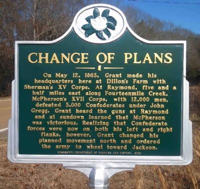
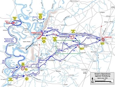
Change of Plans
Erected 2013 by Mississippi Department of Archives and History.
Topics and series. This historical marker is listed in this topic list: War, US Civil. In addition, it is included in the Mississippi State Historical Marker Program series list. A significant historical month for this entry is May 1838.
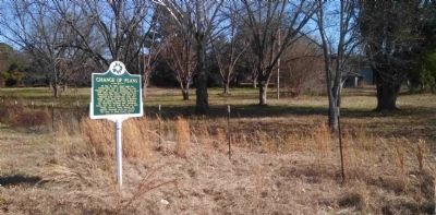
Location. 32° 13.918′ N, 90° 32.533′ W. Marker is in Edwards, Mississippi, in Hinds County. Marker is on Old Port Gibson Road, 0.2 miles west of Mt. Moriah Road, on the right when traveling east. Touch for map. Marker is at or near this postal address: 13452 Old Port Gibson Rd, Edwards MS 39066, United States of America. Touch for directions.
Other nearby markers. At least 8 other markers are within 6 miles of this marker, measured as the crow flies. Deans Stand (approx. 0.2 miles away); Contested Crossing (approx. 0.8 miles away); North to the Railroads (approx. 4.9 miles away); Battle of Raymond (approx. 5 miles away); Artillery Duel (approx. 5.1 miles away); 1863 Vicksburg Campaign (approx. 5.1 miles away); The Vicksburg Campaign (approx. 5.1 miles away); Indecision! Indecision! Indecision!/A Prompt Concentration of Our Forces (approx. 5.1 miles away). Touch for a list and map of all markers in Edwards.
Also see . . .
1. Historic Civil War Site Acquired By Natchez Trace Parkway. "Dillon's Plantation Witnesses History Again" by Rebecca Drake and Parker Hills (Submitted on January 11, 2015, by Cleo Robertson of Fort Lauderdale, Florida.)
2. Ninety-eight Days: A Geographer's View of the Vicksburg Campaign. Index to Dillon's Farm (Plantation) references, pages 224-228, 239, 241, 258, 262-264, 266, 273-274, 442, 515. (Submitted on January 11, 2015, by Cleo Robertson of Fort Lauderdale, Florida.)
3. Discovery Tour of the Vicksburg Campaign Trail. The Campaign for Vicksburg and A Guide to the Campaign Trail. (Submitted on January 11, 2015, by Cleo Robertson of Fort Lauderdale, Florida.)
4. Wikipedia: XV Corps (Union Army). (Submitted on January 11, 2015, by Cleo Robertson of Fort Lauderdale, Florida.)
5. Army of the Tennessee: The Vicksburg Campaign. (Submitted on January 11, 2015, by Cleo Robertson of Fort Lauderdale, Florida.)
6. Civil War Almanac: May 9-12, 1863. Chronology detailed on pages 294-295. (Submitted on January 11, 2015, by Cleo Robertson of Fort Lauderdale, Florida.)
Credits. This page was last revised on November 5, 2020. It was originally submitted on January 11, 2015, by Cleo Robertson of Fort Lauderdale, Florida. This page has been viewed 623 times since then and 45 times this year. Photos: 1, 2, 3, 4, 5, 6, 7. submitted on January 11, 2015, by Cleo Robertson of Fort Lauderdale, Florida. • Bernard Fisher was the editor who published this page.
