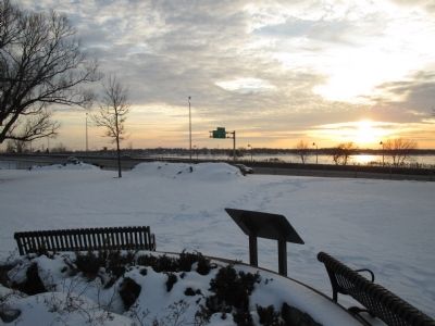
Riverside in Buffalo in Erie County, New York — The American Northeast (Mid-Atlantic)
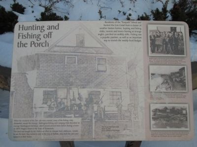
Hunting and Fishing off the Porch
Residents of the "Towpath" fished and hunted the Erie Canal from a cluster of weather beaten homes, hunting and fishing clubs, taverns and stores leaning at strange angles, perched on wobbly stilts. Fishing was a popular pastime, as well as an important way to stretch the weekly food budget.
When the residents of the towpath were evicted, many of the fishing clubs were disbanded, except for the George Washington Fishing and Camping Club (founded on George Washington's birthday), which moved several times before finding a home at 2805 Niagara Street in the Town of Tonawanda.
This land was bought by the club in an effort to relocate their clubhouse. Unable to use the land, they turned it over to the City of Buffalo, who built this park and named it in their honor.
The George Washington Club, March 24 1957. Photo courtesy of Frank Plazik.
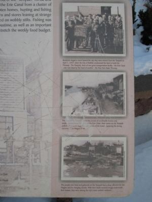
Residents staged a mock funeral the day they were evicted from the Towpath in [sic] April 1, 1957, when the City of Buffalo condemned the land to build the Thruway. The Towpath, born of one great transportation facility - the Erie Canal - was now dead by the hand of another - the New York State Thruway. Photo courtesy of the Buffalo & Erie County Historical Society.
This view of the Towpath shows the cluster of ramshakle houses and establishments lining the banks of the Erie Canal. Mule teams on the Towpath pulled the boats through the calm waters of the Canal, bypassing the strong currents of the Niagara River. Photo courtesy of the Buffalo & Erie County Historical Society.
The people who lived and gathered on the Towpath had a deep affection for the Niagara and its changing moods. With their boats moored snugly underneath their homes, they were among the city's most content residents. Photo courtesy of the Buffalo & Erie County Historical Society.
Topics and series. This historical marker is listed in this topic list: Waterways & Vessels. In addition, it is included in the Erie Canal, and the Former U.S. Presidents: #01 George Washington series lists. A significant historical date for this entry is April 1, 1957.
Location. 42° 56.862′ N, 78° 54.502′ W. Marker is in Buffalo, New York, in Erie County. It is in Riverside. Marker is at the intersection of Niagara Street (Route 266) and Collaton Street, on the right when traveling south on Niagara Street. Marker is in George Washington Park, facing the Niagara River, not Niagara Street. The park is very narrow, sandwiched between I-190 and Niagara Street. Touch for map. Marker is in this post office area: Buffalo NY 14207, United States of America. Touch for directions.
Other nearby markers. At least 8 other markers are within walking distance of this marker. Niagara River Corridor / Avian Walk (about 400 feet away, measured in a direct line); The Niagara River
(approx. 0.2 miles away); Bernard G. Hitro Jr. (approx. 0.4 miles away); Tow Path Park (approx. half a mile away); In Memory of the Sons and Daughters (approx. half a mile away); The Fenian Invasion of 1866 (approx. 0.6 miles away); Park with a View (approx. 0.6 miles away); Erected by the Grateful People (approx. 0.6 miles away). Touch for a list and map of all markers in Buffalo.
More about this marker. This area of Buffalo is known as "Riverside".
Credits. This page was last revised on February 16, 2023. It was originally submitted on January 25, 2015, by Anton Schwarzmueller of Wilson, New York. This page has been viewed 447 times since then and 19 times this year. Photos: 1, 2, 3, 4, 5. submitted on January 25, 2015, by Anton Schwarzmueller of Wilson, New York.
